Geolocate

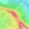
Tigers topographic map

Click on the map to display elevation.

About this map

Name: Tigers topographic map, elevation, terrain.

Location: Tigers, City Park, 14th district, Budapest, XIII. kerület, Central Hungary, 1146, Hungary (47.51989 19.07832 47.52017 19.07888)

Average elevation: 111 m

Minimum elevation: 102 m

Maximum elevation: 122 m

Other topographic maps

Click on a map to view its topography, its elevation and its terrain.
22nd district

Hungary > Budapest

Average elevation: 126 m

2nd district

Hungary > Budapest

Average elevation: 252 m

Gellért Hill

Hungary > Budapest

Average elevation: 126 m

8th district

Hungary > Budapest

Average elevation: 115 m

13th district

Hungary > Budapest

Average elevation: 110 m

Kis-Sváb-hegy

Hungary > Budapest

Average elevation: 195 m

Gellért Hill

Hungary > Budapest

Average elevation: 126 m

1075

Hungary > Budapest

Average elevation: 118 m

9th district

Hungary > Budapest

Average elevation: 112 m

Infopark

Hungary > Budapest

Average elevation: 109 m

1123

Hungary > Budapest

Average elevation: 160 m

12th district

Hungary > Budapest

Average elevation: 267 m

3rd district

Hungary > Budapest

Average elevation: 164 m

8th district

Hungary > Budapest

Average elevation: 115 m

Népsziget

Hungary > Budapest

Average elevation: 107 m

Csúcs-hegy

Hungary > Budapest

Average elevation: 261 m

Ziggurat

Hungary > Budapest

Average elevation: 108 m

8th district

Hungary > Budapest

Average elevation: 115 m

15th district

Hungary > Budapest

Average elevation: 121 m

1st district

Hungary > Budapest

Average elevation: 137 m

Budafok

Hungary > Budapest

Average elevation: 126 m

16th district

Hungary > Budapest

Average elevation: 152 m

10th district

Hungary > Budapest

Average elevation: 129 m

1025

Hungary > Budapest

Average elevation: 255 m

11th district

Hungary > Budapest

Average elevation: 139 m

5th district

Hungary > Budapest

Average elevation: 122 m

13th district

Hungary > Budapest

Average elevation: 110 m

Hármashatárhegy

Hungary > Budapest

Average elevation: 292 m

9th district

Hungary > Budapest

Average elevation: 112 m

6th district

Hungary > Budapest

Average elevation: 114 m

11th district

Hungary > Budapest

Average elevation: 139 m

7th district

Hungary > Budapest

Average elevation: 115 m

10th district

Hungary > Budapest

Average elevation: 129 m

Istenhegy

Hungary > Budapest

Average elevation: 247 m

5th district

Hungary > Budapest

Average elevation: 122 m

5th district

Hungary > Budapest

Average elevation: 122 m

11th district

Hungary > Budapest

Average elevation: 139 m

1119

Hungary > Budapest

Average elevation: 112 m

13th district

Hungary > Budapest

Average elevation: 110 m

23rd district

Hungary > Budapest

Average elevation: 111 m

2nd district

Hungary > Budapest

Average elevation: 252 m

1095

Hungary > Budapest

Average elevation: 107 m

8th district

Hungary > Budapest

Average elevation: 115 m

Békásmegyer

Hungary > Budapest

Average elevation: 127 m

6th district

Hungary > Budapest

Average elevation: 114 m

18th district

Hungary > Budapest

Average elevation: 127 m

14th district

Hungary > Budapest

Average elevation: 116 m

Gear up for your next adventure:

🧴Sunscreen SPF - Broad-spectrum sunscreen for outdoor activities
🏕️Camping Hammock - Integrated protection for sleeping between trees
🥾Waterproof Hiking Boots - Essential footwear for rugged terrain and wet Canadian trails
🧥Thermal Layer - Insulating layer for cold outdoor conditions
🧢Outdoor Visor - Breathable visor for sunny hikes

As an Amazon Associate, this site earns from qualifying purchases at no extra cost to you.