Geolocate

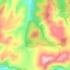
Villamanín topographic map

Click on the map to display elevation.

About this map
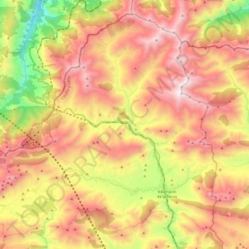
Name: Villamanín topographic map, elevation, terrain.

Location: Villamanín, León, Castile and León, Spain (42.90878 -5.83814 43.05688 -5.61148)

Average elevation: 1,440 m

Minimum elevation: 564 m

Maximum elevation: 2,177 m

Other topographic maps

Click on a map to view its topography, its elevation and its terrain.
Camino de Santiago

Spain > Castile and León > Zazuar

Average elevation: 848 m

Sorriba del Esla

Spain > Castile and León > Cistierna

Average elevation: 1,021 m

Sahechores de Rueda

Spain > Castile and León

Average elevation: 885 m

Río de la Mora

Spain > Castile and León > Navalacruz

Average elevation: 1,495 m

Toroño

Spain > Castile and León > Porto

Average elevation: 1,495 m

Castroañe

Spain > Castile and León > Villaselán

Average elevation: 873 m

Gear up for your next adventure:

🧥Fleece Jacket - Warm and lightweight jacket for layering
🛏️Sleeping Bag - Warm and compact sleeping bags for outdoor camping
🥤Collapsible Travel Cup - Saves space and weight in your mess kit
🔦LED Flashlight - Powerful and long-lasting flashlight for camping and emergencies
🎒Hiking Daypack - Lightweight and durable backpacks for day trips and excursions

As an Amazon Associate, this site earns from qualifying purchases at no extra cost to you.