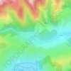
Sântimbru topographic map
Click on the map to display elevation.
Sântimbru
The commune is located in central Alba County, 9 km (5.6 mi) north of the county seat, Alba Iulia. It is situated on the Transylvanian Plateau, at an altitude of 216 m (709 ft). It lies on the banks of the river Mureș; the river Galda flows into the Mureș in Sântimbru.
About this map

Name: Sântimbru topographic map, elevation, terrain.
Location: Sântimbru, Alba, Romania (46.08848 23.59944 46.17699 23.71069)
Average elevation: 271 m
Minimum elevation: 218 m
Maximum elevation: 437 m
Other topographic maps
Click on a map to view its topography, its elevation and its terrain.