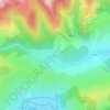
Rimetea topographic map
Click on the map to display elevation.
Rimetea
Rimetea lies in the Apuseni Mountains of central Transylvania, in a valley 23 kilometres (14 miles) north of Aiud. The village rests at an altitude of 650 metres (2,130 feet), on the banks of the river Rimetea. It is nestled between the peaks of Piatra Secuiului (1,128 m (3,701 ft)) and Ardașcheia (1,250 m (4,100 ft)), in the Trascău Mountains. The distinct location of Rimetea at the bottom of Piatra Secuiului (Székelykő) gives it a unique characteristic, since in the village the sun appears to "rise twice" – once above the horizon, before disappearing behind the mountain, and emerging again.
About this map

Name: Rimetea topographic map, elevation, terrain.
Location: Rimetea, Alba, Romania (46.39590 23.49633 46.49718 23.61450)
Average elevation: 735 m
Minimum elevation: 386 m
Maximum elevation: 1,261 m
Other topographic maps
Click on a map to view its topography, its elevation and its terrain.