
Highland topographic map
Click on the map to display elevation.
About this map
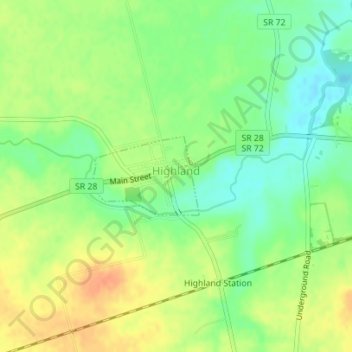
Name: Highland topographic map, elevation, terrain.
Location: Highland, Highland County, Ohio, 45132, United States (39.34108 -83.60580 39.34712 -83.59512)
Average elevation: 326 m
Minimum elevation: 306 m
Maximum elevation: 347 m
Other topographic maps
Click on a map to view its topography, its elevation and its terrain.