Geolocate

Dodsonville topographic map

Click on the map to display elevation.

About this map

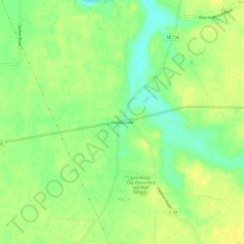
Name: Dodsonville topographic map, elevation, terrain.

Location: Dodsonville, Highland County, Ohio, 45142, United States (39.18229 -83.83465 39.22229 -83.79465)

Average elevation: 309 m

Minimum elevation: 295 m

Maximum elevation: 319 m

Other topographic maps

Click on a map to view its topography, its elevation and its terrain.

Rocky Fork Lake

United States > Ohio > Highland County

Average elevation: 291 m

Lynchburg

United States > Ohio > Highland County

Average elevation: 310 m

Hillsboro

United States > Ohio > Highland County

Average elevation: 313 m

Highland

United States > Ohio > Highland County

Average elevation: 326 m

Paint Creek Lake

United States > Ohio > Highland County

Average elevation: 277 m

Mowrystown

United States > Ohio > Highland County

Average elevation: 299 m

Gear up for your next adventure:

🪑Ultralight Camping Stool - Compact seating for rest stops during long hikes
🔭Compact Binoculars - Lightweight optics for scouting trails and wildlife
🧰Multitool Knife - Compact and versatile tool for outdoor use
🧣Evaporative Cooling Towel - Beat the heat during intense summer climbs
🧥Thermal Fleece Jacket - Versatile insulation for changing mountain temperatures

As an Amazon Associate, this site earns from qualifying purchases at no extra cost to you.