Geolocate

Rainsboro topographic map

Click on the map to display elevation.

About this map

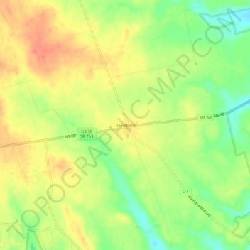
Name: Rainsboro topographic map, elevation, terrain.

Location: Rainsboro, Highland County, Ohio, United States (39.20007 -83.44214 39.24007 -83.40214)

Average elevation: 283 m

Minimum elevation: 252 m

Maximum elevation: 308 m

Other topographic maps

Click on a map to view its topography, its elevation and its terrain.

Rocky Fork Lake

United States > Ohio > Highland County

Average elevation: 291 m

Lynchburg

United States > Ohio > Highland County

Average elevation: 310 m

Hillsboro

United States > Ohio > Highland County

Average elevation: 313 m

Highland

United States > Ohio > Highland County

Average elevation: 326 m

Paint Creek Lake

United States > Ohio > Highland County

Average elevation: 277 m

Mowrystown

United States > Ohio > Highland County

Average elevation: 299 m

Gear up for your next adventure:

🛏️Sleeping Bag - Warm and compact sleeping bags for outdoor camping
🔪Outdoor Multitool - Versatile tool for repairs and food prep in the wild
🏃Hydration Running Vest - Carry water and maps close to your body for speed
🧣Evaporative Cooling Towel - Beat the heat during intense summer climbs
🧢Hiking Sun Hat - Wide-brimmed protection for exposed mountain ridges

As an Amazon Associate, this site earns from qualifying purchases at no extra cost to you.