Geolocate

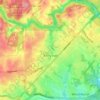
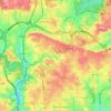
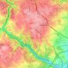
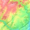
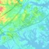
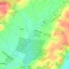
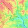
Granite topographic map

Click on the map to display elevation.

About this map

Name: Granite topographic map, elevation, terrain.

Location: Granite, Baltimore County, Maryland, 21163, United States (39.32233 -76.87394 39.36233 -76.83394)

Average elevation: 126 m

Minimum elevation: 75 m

Maximum elevation: 163 m

Other topographic maps

Click on a map to view its topography, its elevation and its terrain.
Hampton

United States > Maryland > Baltimore County > Hampton

Average elevation: 108 m

Woodlawn

United States > Maryland > Baltimore County > Woodlawn

Average elevation: 127 m

Towson

United States > Maryland > Baltimore County > Towson

Average elevation: 114 m

Parkville

United States > Maryland > Baltimore County > Parkville

Average elevation: 111 m

Rosedale

United States > Maryland > Baltimore County > Rosedale

Average elevation: 28 m

Overlea

United States > Maryland > Baltimore County > Overlea

Average elevation: 63 m

Timonium

United States > Maryland > Baltimore County > Timonium

Average elevation: 113 m

Carney

United States > Maryland > Baltimore County > Oakleigh

Average elevation: 103 m

Essex

United States > Maryland > Baltimore County > Essex

Average elevation: 6 m

Lochearn

United States > Maryland > Baltimore County > Lochearn

Average elevation: 135 m

Parkville

United States > Maryland > Baltimore County > Parkville

Average elevation: 111 m

Lake Roland

United States > Maryland > Baltimore County > Towson > Ruxton

Average elevation: 99 m

Carney

United States > Maryland > Baltimore County > Oakleigh

Average elevation: 103 m

Towson

United States > Maryland > Baltimore County > Towson

Average elevation: 114 m

Rosedale

United States > Maryland > Baltimore County > Rosedale

Average elevation: 28 m

Lochearn

United States > Maryland > Baltimore County > Lochearn

Average elevation: 135 m

Lochearn

United States > Maryland > Baltimore County > Lochearn

Average elevation: 135 m

Woodlawn

United States > Maryland > Baltimore County > Woodlawn

Average elevation: 127 m

Hampton

United States > Maryland > Baltimore County > Hampton

Average elevation: 108 m

Wetherfield

United States > Maryland > Baltimore County

Average elevation: 96 m

Woodlawn

United States > Maryland > Baltimore County > Woodlawn

Average elevation: 127 m

Parkville

United States > Maryland > Baltimore County > Parkville

Average elevation: 111 m

Parkville

United States > Maryland > Baltimore County > Parkville

Average elevation: 111 m

Overlea

United States > Maryland > Baltimore County > Overlea

Average elevation: 63 m

West Wind

United States > Maryland > Baltimore County

Average elevation: 147 m

Gear up for your next adventure:

🧼Travel Hand Sanitizer - Keep hands clean when water is scarce
🥾Mountaineering Boots - Supportive boots for climbing and high-altitude hiking
🔥Emergency Fire Starter - Reliable ignition source for all weather conditions
🧦Hiking Socks - Moisture-wicking and comfortable socks for long hikes
🦟Insect Repellent - Keep mosquitoes and black flies away in wooded areas

As an Amazon Associate, this site earns from qualifying purchases at no extra cost to you.