Geolocate

Lansdowne topographic map

Click on the map to display elevation.

About this map

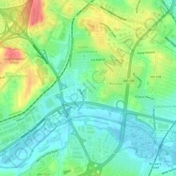
Name: Lansdowne topographic map, elevation, terrain.

Location: Lansdowne, Baltimore County, Maryland, United States (39.21874 -76.69375 39.25545 -76.64442)

Average elevation: 24 m

Minimum elevation: -1 m

Maximum elevation: 68 m

Gear up for your next adventure:

🧴Sunscreen SPF - Broad-spectrum sunscreen for outdoor activities
🧤Rechargeable Heated Gloves - Extreme warmth for Canadian winter expeditions
🩹Moleskin Blister Pads - Direct protection for painful foot pressure points
🚲MTB Frame Bag - Carry tools and maps directly on your bicycle frame
🧴Outdoor Sunscreen - High SPF protection for high-altitude UV exposure

As an Amazon Associate, this site earns from qualifying purchases at no extra cost to you.