Geolocate

Parkville topographic map

Click on the map to display elevation.

About this map

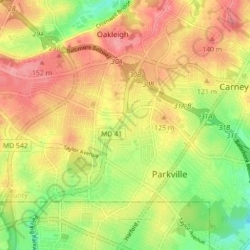
Name: Parkville topographic map, elevation, terrain.

Location: Parkville, Baltimore County, Maryland, 21234, United States (39.37160 -76.58202 39.40208 -76.51970)

Average elevation: 111 m

Minimum elevation: 58 m

Maximum elevation: 155 m

Gear up for your next adventure:

👟Leg Gaiters - Keep debris, mud, and snow out of your boots
Family Camping Tent - Spacious tent suitable for family camping trips
💡LED Headlamp - Hands-free illumination for night hiking and camping
👟Sport Hiking Sandals - Breathable footwear for water crossings and camp rest
🧣Merino Neck Gaiter - Protects against wind, sun, and cold at high altitudes

As an Amazon Associate, this site earns from qualifying purchases at no extra cost to you.