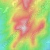
Castell de l'Areny topographic map
Click on the map to display elevation.
About this map

Name: Castell de l'Areny topographic map, elevation, terrain.
Location: Castell de l'Areny, Berguedà, Barcelona, Cataluña, 08604, España (42.14703 1.91072 42.20475 1.99215)
Average elevation: 1,217 m
Minimum elevation: 709 m
Maximum elevation: 1,772 m
Other topographic maps
Click on a map to view its topography, its elevation and its terrain.











Pont de Sant Nazari
España > Cataluña > Berguedà > Guardiola de Berguedà > Gréixer
Average elevation: 1,203 m