Pla Gran de l'Ametlla topographic map
Interactive map
Click on the map to display elevation.
About this map
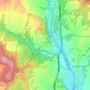
Name: Pla Gran de l'Ametlla topographic map, elevation, terrain.
Average elevation: 523 m
Minimum elevation: 444 m
Maximum elevation: 637 m

Click on the map to display elevation.
Name: Pla Gran de l'Ametlla topographic map, elevation, terrain.
Average elevation: 523 m
Minimum elevation: 444 m
Maximum elevation: 637 m