Geolocate

Saldes topographic map

Click on the map to display elevation.

About this map

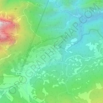
Name: Saldes topographic map, elevation, terrain.

Location: Saldes, Berguedà, Barcelona, Cataluña, 08697, España (42.20876 1.71495 42.24876 1.75495)

Average elevation: 1,344 m

Minimum elevation: 940 m

Maximum elevation: 2,424 m

Gear up for your next adventure:

🧭GPS Handheld Device - Reliable GPS navigation for outdoor adventures
🏃Hydration Running Vest - Carry water and maps close to your body for speed
🧥Softshell Jacket - Windproof and breathable jacket for hiking
🥾Waterproof Hiking Boots - Essential footwear for rugged terrain and wet Canadian trails
🪜Heavy Duty Carabiners - Multi-use clips for securing gear to your backpack

As an Amazon Associate, this site earns from qualifying purchases at no extra cost to you.