Geolocate

Sorba topographic map

Click on the map to display elevation.

About this map

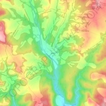
Name: Sorba topographic map, elevation, terrain.

Location: Sorba, Montmajor, Berguedà, Barcelona, Cataluña, España (41.94777 1.64849 41.98777 1.68849)

Average elevation: 545 m

Minimum elevation: 463 m

Maximum elevation: 624 m

Gear up for your next adventure:

👟Trail Running Shoes - Agile footwear for fast-paced topographic exploration
🕯️Camping Lantern - Illuminates your entire campsite with high-efficiency LEDs
💡Compact LED Flashlight - Powerful and portable flashlight for outdoor use
Camping Groundsheet - Protect your tent from moisture and dirt
🧢Hiking Sun Hat - Wide-brimmed protection for exposed mountain ridges

As an Amazon Associate, this site earns from qualifying purchases at no extra cost to you.