
Make a donation
Gear up for your next adventure:
As an Amazon Associate, this site earns from qualifying purchases at no extra cost to you.
Roppen topographic map
Click on the map to display elevation.
Make a donation
Gear up for your next adventure:
As an Amazon Associate, this site earns from qualifying purchases at no extra cost to you.
About this map
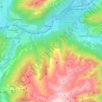
Name: Roppen topographic map, elevation, terrain.
Location: Roppen, Bezirk Imst, Tirol, 6426, Österreich (47.14065 10.78752 47.24493 10.84771)
Average elevation: 1,470 m
Minimum elevation: 667 m
Maximum elevation: 2,939 m
Make a donation
Gear up for your next adventure:
As an Amazon Associate, this site earns from qualifying purchases at no extra cost to you.
Other topographic maps
Click on a map to view its topography, its elevation and its terrain.
Haiming
Österreich > Tirol > Bezirk Imst > Gemeinde Haiming
Haiming ist eine Gemeinde im Oberinntal in Tirol, Österreich, zwischen Telfs und Imst gelegen. Die Gemeinde befindet sich im Bezirk Imst (Gerichtsbezirk Silz), hat 4825 Einwohner (Stand 1. Jänner 2022) und erstreckt sich in 670 Metern Höhe über eine Fläche von 40,21 km².
Average elevation: 957 m
Make a donation
Gear up for your next adventure:
As an Amazon Associate, this site earns from qualifying purchases at no extra cost to you.
Wildes Mannle
Österreich > Tirol > Bezirk Imst > Gemeinde Sölden
Inzwischen wurde eine zweite Seilbahn (Sechser-Sessellift "Wildes Mannle"), die ab Stablein bis in etwa 2640 m Höhe führt, in Betrieb genommen. Diese verkürzt den Aufstieg ab Stablein um eine Stunde.
Average elevation: 2,778 m
Make a donation
Gear up for your next adventure:
As an Amazon Associate, this site earns from qualifying purchases at no extra cost to you.
Make a donation
Gear up for your next adventure:
As an Amazon Associate, this site earns from qualifying purchases at no extra cost to you.
Gaislachkogel
Österreich > Tirol > Bezirk Imst > Gemeinde Sölden
Der Gaislachkogel (auch Hinterer Geislachkogel, Gaislacher Kogel oder Geislacher Kogel) ist ein 3056 m ü. A. hoher Berg in den Ötztaler Alpen in Tirol, Österreich. Er befindet sich westlich von Sölden im Ötztal und nördlich des Venter Tals. Der nächsthöhere Berg ist die Äußere Schwarze Schneid (3255…
Average elevation: 2,620 m
Make a donation
Gear up for your next adventure:
As an Amazon Associate, this site earns from qualifying purchases at no extra cost to you.
Eggenstall
Österreich > Tirol > Bezirk Imst > Gemeinde St. Leonhard im Pitztal > Sankt Leonhard im Pitztal
Average elevation: 1,892 m
Ramolhaus
Österreich > Tirol > Bezirk Imst > Gemeinde Sölden
Der Aufstieg erfolgt von Obergurgl (1927 m) auf dem bezeichneten Weitwanderweg Nr. 902 in einer Gehzeit von vier Stunden. In Obergurgl wird zunächst die Gurgler Ache in südwestlicher Richtung überquert. Der Weg führt zunächst am westlichen Talhang in zwei Kehren empor, quert dann einen Bach und führt…
Average elevation: 2,855 m
Make a donation
Gear up for your next adventure:
As an Amazon Associate, this site earns from qualifying purchases at no extra cost to you.
Zaunhof
Österreich > Tirol > Bezirk Imst > Gemeinde St. Leonhard im Pitztal
Average elevation: 1,821 m