
Thank you for supporting this site ❤️
Make a donation
Make a donation
Gear up for your next adventure:
As an Amazon Associate, this site earns from qualifying purchases at no extra cost to you.
Rammstein topographic map
Click on the map to display elevation.
Thank you for supporting this site ❤️
Make a donation
Make a donation
Gear up for your next adventure:
As an Amazon Associate, this site earns from qualifying purchases at no extra cost to you.
About this map
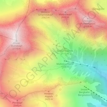
Name: Rammstein topographic map, elevation, terrain.
Location: Rammstein, Stadt Imst, Bezirk Imst, Tirol, 6460, Österreich (47.26414 10.66520 47.26431 10.66574)
Average elevation: 2,248 m
Minimum elevation: 1,634 m
Maximum elevation: 2,752 m
Thank you for supporting this site ❤️
Make a donation
Make a donation
Gear up for your next adventure:
As an Amazon Associate, this site earns from qualifying purchases at no extra cost to you.