
Thank you for supporting this site ❤️
Make a donation
Make a donation
Gear up for your next adventure:
As an Amazon Associate, this site earns from qualifying purchases at no extra cost to you.
Nederkogel topographic map
Click on the map to display elevation.
Thank you for supporting this site ❤️
Make a donation
Make a donation
Gear up for your next adventure:
As an Amazon Associate, this site earns from qualifying purchases at no extra cost to you.
About this map
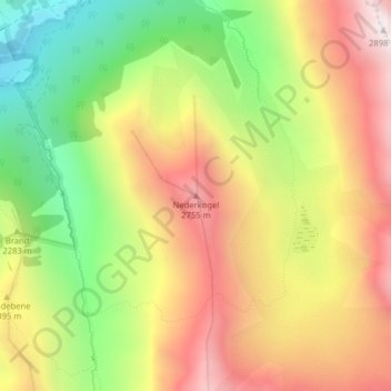
Name: Nederkogel topographic map, elevation, terrain.
Location: Nederkogel, Umhausen, Bezirk Imst, Tirol, Österreich (47.12806 11.00576 47.12816 11.00586)
Average elevation: 2,291 m
Minimum elevation: 1,687 m
Maximum elevation: 2,875 m
Thank you for supporting this site ❤️
Make a donation
Make a donation
Gear up for your next adventure:
As an Amazon Associate, this site earns from qualifying purchases at no extra cost to you.