Geolocate

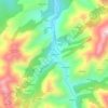
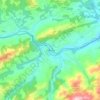
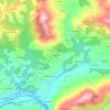
Borines topographic map

Click on the map to display elevation.

About this map

Name: Borines topographic map, elevation, terrain.

Location: Borines, Piloña, Asturias, 33534, España (43.36982 -5.35520 43.41667 -5.28153)

Average elevation: 338 m

Minimum elevation: 91 m

Maximum elevation: 872 m

Other topographic maps

Click on a map to view its topography, its elevation and its terrain.
Lludeña

España > Asturias > Piloña

Average elevation: 310 m

Espinaredo

España > Asturias > Piloña > Espinaredo

Average elevation: 491 m

La Comba

España > Asturias > Piloña > La Comba

Average elevation: 508 m

Pandavenes

España > Asturias > Piloña

Average elevation: 419 m

Bierces

España > Asturias > Piloña

Average elevation: 376 m

Aguin

España > Asturias > Piloña > Villamayor

Average elevation: 190 m

Infiesto

España > Asturias > Piloña

Average elevation: 312 m

Pesquerín

España > Asturias > Piloña

Average elevation: 354 m

Melardi

España > Asturias > Piloña

Average elevation: 282 m

El Pascual

España > Asturias > Piloña

Average elevation: 250 m

Beroñes

España > Asturias > Piloña

Average elevation: 444 m

Riquimáu

España > Asturias > Piloña

Average elevation: 554 m

El Calzáu

España > Asturias > Piloña

Average elevation: 264 m

La Matosa

España > Asturias > Piloña

Average elevation: 424 m

Serpiedo

España > Asturias > Piloña > Coya

Average elevation: 282 m

Bierces

España > Asturias > Piloña

Average elevation: 376 m

Santa Llocaya

España > Asturias > Piloña > Infiesto

Average elevation: 288 m

Gear up for your next adventure:

🧢Beanie Hat - Keep your head warm in cold weather
🥾Hiking Shoes - Durable and comfortable shoes for trail hiking
⛺Camping Groundsheet - Protect your tent from moisture and dirt
🥾Trail Running Shoes - Lightweight and durable shoes for trail running
🪑Insulated Seat Pad - Protect your seat from cold rocks and wet logs

As an Amazon Associate, this site earns from qualifying purchases at no extra cost to you.