Geolocate

Melardi topographic map

Click on the map to display elevation.

About this map

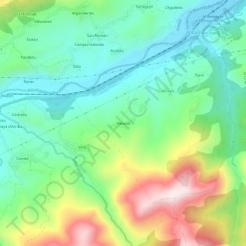
Name: Melardi topographic map, elevation, terrain.

Location: Melardi, Villamayor, Piloña, Asturias, 33583, España (43.32446 -5.34338 43.36446 -5.30338)

Average elevation: 282 m

Minimum elevation: 101 m

Maximum elevation: 651 m

Other topographic maps

Click on a map to view its topography, its elevation and its terrain.

Miyares

España > Asturias > Piloña

Average elevation: 221 m

Gear up for your next adventure:

Camping Tent - Weather-resistant tents suitable for 2 to 6 people
🔦LED Headlamp - Hands-free lighting for early morning starts or late finishes
Lightweight Backpacking Tent - Compact tent for efficient hiking trips
🧥Thermal Fleece Jacket - Versatile insulation for changing mountain temperatures
Family Camping Tent - Spacious tent suitable for family camping trips

As an Amazon Associate, this site earns from qualifying purchases at no extra cost to you.