Geolocate

Bierces topographic map

Click on the map to display elevation.

About this map

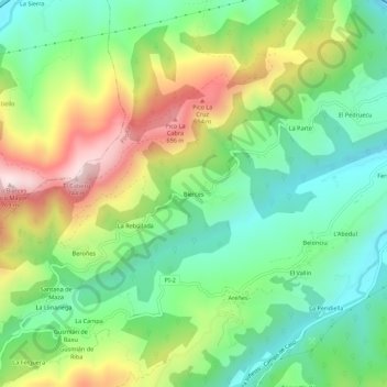
Name: Bierces topographic map, elevation, terrain.

Location: Bierces, Ques, Piloña, Asturias, 33530, España (43.31477 -5.42934 43.35477 -5.38934)

Average elevation: 376 m

Minimum elevation: 158 m

Maximum elevation: 746 m

Other topographic maps

Click on a map to view its topography, its elevation and its terrain.

Miyares

España > Asturias > Piloña

Average elevation: 221 m

Gear up for your next adventure:

🧭GPS Tracker - Track your location in remote areas safely
🥾Hiking Gaiters - Protect legs and shoes from mud, snow, and debris
🧥Softshell Hiking Jacket - The perfect balance of wind protection and breathability
📷Outdoor Action Camera - Capture high-elevation views and rugged adventures
🧦Outdoor Socks - Durable socks designed for hiking and outdoor sports

As an Amazon Associate, this site earns from qualifying purchases at no extra cost to you.