

Ontario topographic maps
Click on a map to view its topography, its elevation and its terrain.
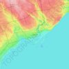
Toronto
Despite its deep ravines, Toronto is not remarkably hilly, but its elevation does increase steadily away from the lake. Elevation differences range from 76.5 metres (251 ft) above sea level at the Lake Ontario shore to 209 m (686 ft) ASL near the York University grounds in the city's north end at the…
Average elevation: 113 m

Christian Island
Canada > Ontario > Simcoe County
Christian Island is a large island in Georgian Bay close to the communities of Penetanguishene and Midland, Ontario. The island, with its neighbours Hope Island and Beckwith Island, is a 5,428.1 hectares (13,413.1 acres) Ojibwa reserve, known as Christian Island Indian Reserve No. 30. Together with the 7.5…
Average elevation: 185 m


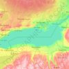
Lake Ontario
Lake Ontario is the easternmost of the Great Lakes and the smallest in surface area (7,340 sq mi, 18,960 km2), although it exceeds Lake Erie in volume (393 cu mi, 1,639 km3). It is the 13th largest lake in the world. When its islands are included, the lake's shoreline is 712 miles (1,146 km) long. As the last…
Average elevation: 214 m

Round Lake
Canada > Ontario > Killaloe, Hagarty and Richards > Round Lake Centre
Average elevation: 178 m

St. Joseph Island
Canada > Ontario > Algoma District > Jocelyn Township
Its highest point, known colloquially and by surveyors as "the Mountain," is near the centre of the island near Carterton with an elevation of 345.6 m, which is about 169 m above Lake Huron.
Average elevation: 196 m

Calabogie Lake
Canada > Ontario > Renfrew County > Greater Madawaska > Calabogie
Average elevation: 181 m





Ara Lake
Canada > Ontario > Thunder Bay District > Unorganized Thunder Bay District
Average elevation: 308 m


Lady Evelyn Lake
Canada > Ontario > Timiskaming District > Unorganized West Timiskaming
Average elevation: 318 m

Beausoleil Island
Canada > Ontario > Muskoka District > Georgian Bay Township
Average elevation: 180 m




Moose Creek
Canada > Ontario > Stormont, Dundas and Glengarry Counties > North Stormont
Average elevation: 87 m
Peterborough
Canada > Ontario > Peterborough
Peterborough's topography is largely defined by land formations created by the receding Wisconsian glaciers 10,000–15,000 years ago. The South End and Downtown portions of the City sit on what was the bottom of the glacial Lake Peterborough—part of a glacial spillway created when glacial meltwaters from…
Average elevation: 235 m



Pelham
Canada > Ontario > Niagara Region > Pelham
From the top of the Fonthill Kame Delta hill, a unique topographical feature (Ontario Geological Society 1970) and ANSI protected site (Area of Natural Scientific Interest - ANSI) on a clear day it is possible to see Toronto, Hamilton and western New York state. At one time, a ski tow was installed on the…
Average elevation: 183 m

Windigo Lake
Canada > Ontario > Kenora District > Unorganized Kenora District
Average elevation: 346 m

Niagara River
Canada > Ontario > Niagara Region > Niagara Falls
The river, which is occasionally described as a strait, is about 58 kilometres (36 mi) long and includes Niagara Falls in its course. The falls have moved approximately 11 kilometres (6.8 mi) upstream from the Niagara Escarpment in the last 12,000 years, resulting in a gorge below the falls. Today, the…
Average elevation: 177 m


Slate Islands
Canada > Ontario > Kenora District > Unorganized Kenora District
Average elevation: 322 m



Mowe Lake
Canada > Ontario > Thunder Bay District > Unorganized Thunder Bay District
Average elevation: 463 m


Lake Temiskaming
Canada > Ontario > Timiskaming District > Unorganized West Timiskaming
Average elevation: 279 m


Wasaga Beach
Canada > Ontario > Simcoe County
The Town of Wasaga Beach covers an area of 61.13 square kilometres (23.60 sq mi) composed predominantly of sand and loamy sand that exhibit excessive to good drainage and irregular to moderately sloping topography. The poor soil quality makes it difficult to sustain lush lawns in the town. The Canada Land…
Average elevation: 190 m



Windermere Lake
Canada > Ontario > Kenora District > Unorganized Kenora District
Average elevation: 422 m


Kashabowie
Canada > Ontario > Thunder Bay District > Unorganized Thunder Bay District
Average elevation: 467 m

Madawaska Highlands
Canada > Ontario > Renfrew County > Killaloe, Hagarty and Richards
Average elevation: 272 m


Shetland Island
Canada > Ontario > Leeds and Grenville Counties > Leeds and the Thousand Islands
Average elevation: 74 m


South-West Oxford
Canada > Ontario > Oxford County
In its wilderness state, the former Dereham township had thousands of acres of swamp and marsh land which limited its use for agriculture. Several large drainage projects brought great improvement and remain as essential parts of the township's farmland infrastructure. The township topography still has several…
Average elevation: 281 m







Ferris Provincial Park
Canada > Ontario > Northumberland County > Trent Hills > Campbellford
Average elevation: 151 m