Geolocate

Windfields Farm topographic map

Click on the map to display elevation.

About this map
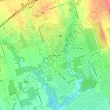
Name: Windfields Farm topographic map, elevation, terrain.

Location: Windfields Farm, Oshawa, Durham Region, Golden Horseshoe, Ontario, L1L 1C4, Canada (43.93183 -78.91406 43.97183 -78.87406)

Average elevation: 162 m

Minimum elevation: 128 m

Maximum elevation: 211 m

Durham Region trails, hiking, mountain biking, running and outdoor activities

Gear up for your next adventure:

💡Compact LED Flashlight - Powerful and portable flashlight for outdoor use
🧳Compression Sacks - Maximize space in your backpack by shrinking gear
🦟Insect Repellent - Keep mosquitoes and black flies away in wooded areas
🥾Trail Hiking Boots - Supportive boots for rough trails
🧥Ultralight Puffy Jacket - Maximum warmth that packs down to the size of an orange

As an Amazon Associate, this site earns from qualifying purchases at no extra cost to you.