Geolocate

Calabogie Lake topographic map

Click on the map to display elevation.

About this map
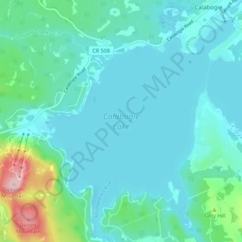
Name: Calabogie Lake topographic map, elevation, terrain.

Location: Calabogie Lake, Calabogie, Greater Madawaska, Renfrew County, Eastern Ontario, Ontario, Canada (45.24989 -76.77798 45.30367 -76.70367)

Average elevation: 181 m

Minimum elevation: 146 m

Maximum elevation: 371 m

Renfrew County trails, hiking, mountain biking, running and outdoor activities

Other topographic maps

Click on a map to view its topography, its elevation and its terrain.
Gear up for your next adventure:

⛺Backpacking Tent - Lightweight tent for long-distance hiking trips
🏃Hydration Running Vest - Carry water and maps close to your body for speed
🛁Quick-Dry Microfiber Towel - Space-saving towel that dries rapidly on the move
🥾Durable Hiking Shoes - Long-lasting shoes for frequent hiking
🥾Mountain Hiking Boots - High-traction boots for rocky terrain

As an Amazon Associate, this site earns from qualifying purchases at no extra cost to you.