Geolocate

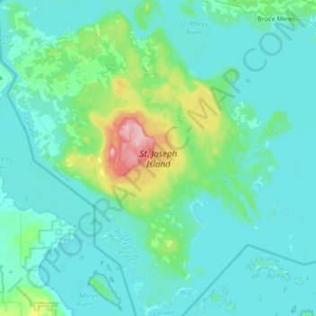
St. Joseph Island topographic map

Click on the map to display elevation.

St. Joseph Island

Its highest point, known colloquially and by surveyors as "the Mountain", is near the centre of the island near Carterton with an elevation of 345.6 m, which is about 169 m above Lake Huron.

Wikipedia (CC-BY-SA 3.0)

About this map

Name: St. Joseph Island topographic map, elevation, terrain.

Location: St. Joseph Island, Jocelyn Township, Algoma District, Northeastern Ontario, Ontario, Canada (46.06113 -84.11427 46.31753 -83.77301)

Average elevation: 196 m

Minimum elevation: 171 m

Maximum elevation: 348 m

Algoma District trails, hiking, mountain biking, running and outdoor activities

Gear up for your next adventure:

🔪Outdoor Multitool - Versatile tool for repairs and food prep in the wild
🪑Ultralight Camping Stool - Compact seating for rest stops during long hikes
🥾Trail Hiking Socks - Comfortable socks to prevent blisters and fatigue
🧴Waterproofing Spray - Restore the DWR coating on jackets and tents
🌡️Emergency Mylar Blankets - Compact thermal protection for unexpected nights outdoors

As an Amazon Associate, this site earns from qualifying purchases at no extra cost to you.