
Mojave topographic map
Interactive map
Click on the map to display elevation.
About this map
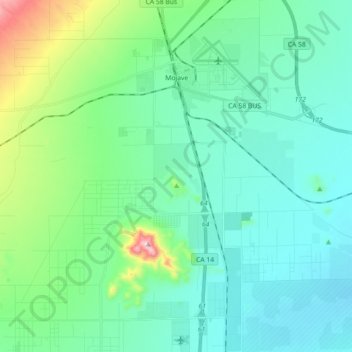
Name: Mojave topographic map, elevation, terrain.
Location: Mojave, Kern County, California, United States (34.93736 -118.25786 35.08440 -118.10427)
Average elevation: 857 m
Minimum elevation: 760 m
Maximum elevation: 1,274 m
Mojave (formerly Mohave) is an unincorporated community in Kern County, California, United States. Mojave is located 50 miles (80 km) east of Bakersfield, and 100 miles (161 km) north of Los Angeles, at an elevation of 2,762 feet (842 m). The town is located in the western region of the Mojave Desert, below and east of Oak Creek Pass and the Tehachapi Mountains. Mojave is on the Pacific Crest Trail.
Other topographic maps
Click on a map to view its topography, its elevation and its terrain.
Upper Richbar Picnic Area
United States > California > Kern County
Upper Richbar Picnic Area, Kern County, California, United States
Average elevation: 658 m
Wasco
United States > California > Kern County
Wasco, Kern County, California, United States
Average elevation: 101 m
Inyokern
United States > California > Kern County
Inyokern, Kern County, California, United States
Average elevation: 749 m
Baker
United States > California > Kern County > Boron
Baker, Boron, Kern County, California, United States
Average elevation: 765 m
Rosedale
United States > California > Kern County
Rosedale, Kern County, CAL Fire Contract Counties, California, United States
Average elevation: 107 m
Ridgecrest
United States > California > Kern County
Ridgecrest, Kern County, California, 93555, United States
Average elevation: 740 m
Lake Isabella
United States > California > Kern County
Lake Isabella, Kern County, California, United States
Average elevation: 979 m
Boron
United States > California > Kern County > Boron
Boron, Kern County, California, United States
Average elevation: 753 m
Tehachapi
United States > California > Kern County
Tehachapi, Kern County, California, 93561, United States
Average elevation: 1,414 m
Cameron
United States > California > Kern County
Cameron, Kern County, California, United States
Average elevation: 1,309 m
Rio Bravo
United States > California > Kern County
Rio Bravo, Kern County, California, United States
Average elevation: 97 m
Bakersfield
United States > California > Kern County
Bakersfield, Kern County, California, United States
Average elevation: 157 m