
Cameron topographic map
Click on the map to display elevation.
About this map
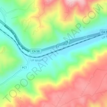
Name: Cameron topographic map, elevation, terrain.
Location: Cameron, Kern County, California, United States (35.08663 -118.30758 35.10663 -118.28758)
Average elevation: 1,309 m
Minimum elevation: 1,153 m
Maximum elevation: 1,519 m
Other topographic maps
Click on a map to view its topography, its elevation and its terrain.
Mojave
United States > California > Kern County
Mojave (formerly Mohave) is an unincorporated community in Kern County, California, United States. Mojave is located 50 miles (80 km) east of Bakersfield, and 100 miles (161 km) north of Los Angeles, at an elevation of 2,762 feet (842 m). The town is located in the western region of the Mojave Desert, below…
Average elevation: 857 m
Ridgecrest
United States > California > Kern County
Walker Pass (elevation 5,250 ft (1.60 km)) is a mountain pass by Lake Isabella in the southern Sierra Nevada mountains. It is located in northeastern Kern County, approximately 53 mi (85 km) ENE of Bakersfield and 10 mi (16 km) WSW of Ridgecrest. The pass provides a route between the San Joaquin Valley on the…
Average elevation: 740 m
Wasco
United States > California > Kern County
Wasco (formerly, Dewey and Deweyville) is a city in the San Joaquin Valley, in Kern County, California, United States. Wasco is located 24 miles (39 km) northwest of Bakersfield, at an elevation of 328 feet (100 m). The population was 25,545 at the 2010 census, up from 21,263 at the 2000 census.
Average elevation: 101 m
Inyokern
United States > California > Kern County
Inyokern (formerly Siding 16 and Magnolia) is a census-designated place (CDP) in Kern County, California, United States. Its name derives from its location near the border between Inyo and Kern Counties. Inyokern is located 8 miles (13 km) west of Ridgecrest, at an elevation of 2,434 feet (742 m). It is on the…
Average elevation: 749 m
Tehachapi
United States > California > Kern County
Tehachapi (/təˈhætʃəpi/ (listen); Kawaiisu: Tihachipia, meaning "hard climb") is a city in Kern County, California, United States, in the Tehachapi Mountains, at an elevation of 3,970 feet (1,210 m), between the San Joaquin Valley and the Mojave Desert. Tehachapi is 35 miles (56 km) east-southeast of…
Average elevation: 1,414 m
Boron
United States > California > Kern County > Boron
Boron (formerly Amargo, Baker, Borate, and Kern)[4] is a census-designated place (CDP) in Kern County, California, United States. Boron is 15 miles (24 km) southwest of Red Rock Mountain at an elevation of 2,467 feet (752 m).[4] The population was 2,086 at the 2020 census, up from 2,025 at the 2000 census.…
Average elevation: 753 m