Geolocate

Mojave topographic map

Click on the map to display elevation.

Mojave

Mojave (formerly Mohave) is an unincorporated community in Kern County, California, United States. Mojave is located 50 miles (80 km) east of Bakersfield, and 100 miles (161 km) north of Los Angeles, at an elevation of 2,762 feet (842 m). The town is located in the western region of the Mojave Desert, below and east of Oak Creek Pass and the Tehachapi Mountains. Mojave is on the Pacific Crest Trail.

Wikipedia (CC-BY-SA 3.0)

About this map

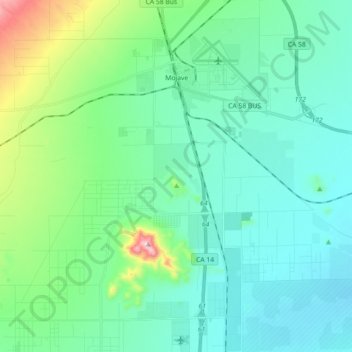
Name: Mojave topographic map, elevation, terrain.

Location: Mojave, Kern County, California, United States (34.93736 -118.25786 35.08440 -118.10427)

Average elevation: 857 m

Minimum elevation: 760 m

Maximum elevation: 1,274 m

Other topographic maps

Click on a map to view its topography, its elevation and its terrain.

Baker

United States > California > Kern County > Boron

Average elevation: 765 m

Fruitvale

United States > California > Kern County

Average elevation: 122 m

Quality

United States > California > Kern County

Average elevation: 155 m

Rosedale

United States > California > Kern County

Average elevation: 113 m

Rio Bravo

United States > California > Kern County

Average elevation: 97 m

Cameron

United States > California > Kern County

Average elevation: 1,309 m

Gear up for your next adventure:

🦌Outdoor Trail Camera - Monitor wildlife activity near your favorite spots
🔋Emergency Crank Radio - Weather alerts and power without needing batteries
🥘Camping Cookware Set - Compact nesting pots and pans for trail cooking
🎒Fully Waterproof Backpack - Total protection for photography gear and electronics
🧥Softshell Hiking Jacket - The perfect balance of wind protection and breathability

As an Amazon Associate, this site earns from qualifying purchases at no extra cost to you.