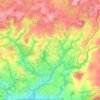
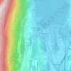
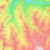
Roc Vaudieu topographic map
Click on the map to display elevation.
About this map

Name: Roc Vaudieu topographic map, elevation, terrain.
Location: Roc Vaudieu, Metropolitan France, France (49.71862 0.22488 49.71908 0.22536)
Average elevation: 31 m
Minimum elevation: 0 m
Maximum elevation: 102 m
Other topographic maps
Click on a map to view its topography, its elevation and its terrain.
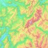
Mont Blanc massif
The massif contains 11 main summits over 4,000 metres (13,123 ft) in altitude, as well as numerous subsidiary points above this height.: 264 Crowning the massif is Mont Blanc (4,808 metres (15,774 ft)), the highest mountain in the Alps and in western Europe.: 278 From the summit of Mont Blanc to the…
Average elevation: 1,710 m
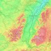
Alsace
Alsace has a semi-continental climate at low altitude and a continental climate at high altitude. There is fairly low precipitation because the Vosges protect it from the west. The city of Colmar has a sunny microclimate; it is the second driest city in France, with an annual precipitation of 600 mm, making it…
Average elevation: 414 m
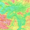
Paris
Paris in its early history had only the rivers Seine and Bièvre for water. From 1809, the Canal de l'Ourcq provided Paris with water from less-polluted rivers to the north-east of the capital. From 1857, the civil engineer Eugène Belgrand, under Napoleon III, oversaw the construction of a series of new…
Average elevation: 75 m
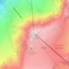
Aiguille du Midi
France > Auvergne-Rhône-Alpes > Upper Savoy > Chamonix-Mont-Blanc
Average elevation: 3,097 m
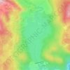
Lac des Bouillouses
France > Occitania > Pyrénées-Orientales > Angoustrine-Villeneuve-des-Escaldes
Lac des Bouillouses or Llac de la Bollosa is a lake in Pyrénées-Orientales, France. At an elevation of 2017 m, its surface area is 1.49 km².
Average elevation: 2,091 m

Aix-les-Bains
France > Auvergne-Rhône-Alpes > Savoy
Aix-Les-Bains is located in the southeast of France, 107 kilometres (66 mi) east of Lyon. The town is located in a corridor between the mountain of Mont Revard, the first natural rampart of the Massif des Bauges to the east and the Lac du Bourget, the largest natural lake of France to the west. Thus, the city…
Average elevation: 348 m
Luz-Saint-Sauveur
France > Occitania > Hautes Pyrenees > Luz-Saint-Sauveur > Luz-Saint-Sauveur
Average elevation: 1,035 m
Les Ménuires
France > Auvergne-Rhône-Alpes > Savoy
The resort was founded in 1964 and has an altitude range of 1,850 m (6,070 ft).
Average elevation: 2,063 m
Auvergne
Auvergne is known for its mountain ranges and dormant volcanoes. Together the Monts Dore and the Chaîne des Puys include 80 volcanoes. The Puy de Dôme is the highest volcano in the region, with an altitude of 1,465 metres (4,806 ft). The Sancy Massif in the Monts Dore is the highest point in Auvergne (1,886…
Average elevation: 587 m
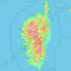
Corsica
Under the Köppen climate classification scheme, coastal regions are characterized by a hot-summer Mediterranean climate (Csa). Further inland, a warm-summer Mediterranean climate (Csb) is more common. At the highest elevation locations, small areas with a subarctic climate (Dsc, Dfc) and the rare cold-summer…
Average elevation: 147 m
Cauterets
France > Occitania > Hautes Pyrenees
The minimum altitude, 503 metres (1,650 ft), is located in the north, where the Gave de Cauterets leaves the communal area and enters that of Soulom. The maximum elevation of 3,298 metres (10,820 ft) corresponds to the highest point of the French Pyrénées, Vignemale, marking the border with Spain [fr]. Other…
Average elevation: 1,817 m
Brittany
France > Brittany > Landerneau > Loudéac
The Armorican massif reaches its maximal elevation outside of Brittany, in neighbouring Mayenne, at 417 m, and slopes towards the west before straightening on its western extremity, with the Montagnes Noires and the Monts d'Arrée. The highest hill in Brittany is the Roc'h Ruz in the Monts d'Arrée, at 385 m…
Average elevation: 50 m
Lac de Sainte-Croix
France > Provence-Alpes-Côte d'Azur > Alpes-de-Haute-Provence > Sainte-Croix-du-Verdon
Average elevation: 584 m


Villefranche-sur-Mer
France > Provence-Alpes-Côte d'Azur > Maritime Alps
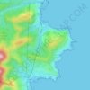
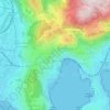
The city limits extend to the hills surrounding the bay climbing from sea level to an altitude of 1,893 feet (577 m), the highest point of Mont-Leuze, reflecting on land the features found offshore. The Basse Corniche runs through Vlllefranche with the Moyenne Corniche above and the Haute Corniche above that…
Average elevation: 146 m


Saint-Dié-des-Vosges
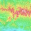
During the sixteenth century, and the long vacancy of the see of Toul, the abbots of the several monasteries in the Vosges, without actually declaring themselves independent of the diocese of Toul, claimed to exercise a quasi-episcopal jurisdiction. In 1718, the Bishop of Toul requested the creation of a see…
Average elevation: 433 m

Riom-ès-Montagnes
France > Auvergne-Rhône-Alpes > Cantal
Main town of the "Pays Gentiane", the city is located northwest of the department of Cantal, in the heart of the regional natural park of Auvergne Volcanoes. Riom-ès-Montagnes is located between the Monts Dore and the Mounts of Cantal at an altitude of 840 meters.
Average elevation: 890 m
Bayonne
France > New Aquitaine > Pyrénées-Atlantiques > Bayonne > Bayonne
In the late Quaternary, the current topographic physiognomy was formed—i.e. a set of hills overlooking a swampy lowland. The promontory of Bassussarry–Marracq ultimately extended to the Labourdin foothills. The Grand Bayonne hill is an example. Similarly, on the right bank of the Nive, the heights of…
Average elevation: 23 m

Raon-l'Étape
Raon-l'Étape is positioned at the mouth of the Plaine [fr] at the point where it converges into the Meurthe, itself a tributary of the Moselle. Because it is on departmental frontier with the adjacent Meurthe-et-Moselle département, Raon-l'Étape is sometimes known as the "Gateway to the Vosges" (porte des…
Average elevation: 362 m

Pont du Loup
France > Provence-Alpes-Côte d'Azur > Maritime Alps > Tourrettes-sur-Loup
Average elevation: 607 m





Le Hohwald
Le Hohwald is a hill village, with altitude above sea level in the commune ranging from 450 meters to nearly 1100 meters, positioned some fifty kilometres to the west-south-west of Strasbourg and some ten kilometres to the south-west of Mont Sainte-Odile. Its position in the lee of mountains protects it from…
Average elevation: 730 m
Pelvoux
France > Provence-Alpes-Côte d'Azur > Hautes-Alpes > Vallouise-Pelvoux
Average elevation: 2,459 m


Les Houches
France > Auvergne-Rhône-Alpes > Upper Savoy
Les Houches, located 6 kilometres from Chamonix, is a ski resort with a domain which extends from an altitude of 950 metres up to 1900 metres. Long descents through tree-lined slopes are combined with impressive views of the Mont Blanc massif and the Chamonix valley.
Average elevation: 1,728 m
Vallouise
France > Provence-Alpes-Côte d'Azur > Hautes-Alpes > Vallouise-Pelvoux
Average elevation: 2,378 m


Prats-de-Mollo-la-Preste
France > Occitania > Pyrénées-Orientales
Prats-de-Mollo-la-Preste is located in the Pyrenees, 13 km (8.1 mi) from the Spanish border and the Autonomous Community of Catalonia, on the banks of the river Tech, and on the south face of the Canigou at an elevation of 735 meters.
Average elevation: 1,295 m