Isère topographic maps
Click on a map to view its topography, its elevation and its terrain.

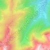
Le Col de l'Arzelier
France > Auvergne-Rhône-Alpes > Isère > Château-Bernard
Average elevation: 1,206 m
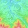
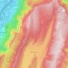
Beaucroissant
France > Auvergne-Rhône-Alpes > Isère
The commune is famous for its annual fair which has continued since 1219 due to the pilgrimage of Our Lady of Parménie. The history of the village and the Fair is linked with the Parménie hill that dominates the commune with its 749-metre altitude.
Average elevation: 438 m

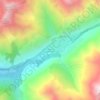
Le Désert en Valjouffrey
France > Auvergne-Rhône-Alpes > Isère > Valjouffrey
Average elevation: 1,815 m