Geolocate

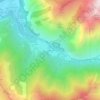
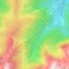
Châtelus topographic map

Click on the map to display elevation.

About this map

Name: Châtelus topographic map, elevation, terrain.

Location: Châtelus, Grenoble, Isère, Auvergne-Rhône-Alpes, Metropolitan France, 38680, France (45.03457 5.34907 45.07178 5.44987)

Average elevation: 621 m

Minimum elevation: 188 m

Maximum elevation: 1,284 m

Other topographic maps

Click on a map to view its topography, its elevation and its terrain.
Station d'Oz en Oisans

France > Auvergne-Rhône-Alpes > Isère > Oz

Average elevation: 1,556 m

Gragnolet

France > Auvergne-Rhône-Alpes > Isère > Entraigues

Average elevation: 1,441 m

Le Pleynet

France > Auvergne-Rhône-Alpes > Isère > Le Haut-Bréda

Average elevation: 1,622 m

Gear up for your next adventure:

🧤Rechargeable Heated Gloves - Extreme warmth for Canadian winter expeditions
❄️Traction Ice Cleats - Slip-on spikes for icy trails and winter hiking
🧤Insulated Winter Gloves - Heavy-duty protection for sub-zero Canadian adventures
🧥Waterproof Hiking Jacket - Protect yourself from rain and wind while hiking
🧴First Aid Kit - Essential first aid supplies for outdoor emergencies

As an Amazon Associate, this site earns from qualifying purchases at no extra cost to you.