Geolocate

Occitania topographic maps

Click on a map to view its topography, its elevation and its terrain.
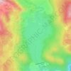
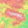
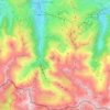
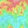
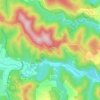
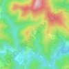
Lac des Bouillouses

France > Occitania > Pyrénées-Orientales > Angoustrine-Villeneuve-des-Escaldes

Lac des Bouillouses or Llac de la Bollosa is a lake in Pyrénées-Orientales, France. At an elevation of 2017 m, its surface area is 1.49 km².

Average elevation: 2,091 m
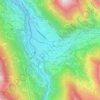
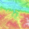
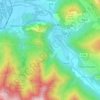
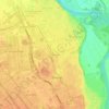
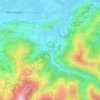
Toulouse

France > Occitania > Haute-Garonne > Toulouse

Average elevation: 173 m

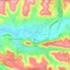
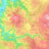
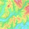
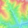
Perpignan

France > Occitania > Pyrénées-Orientales > Perpignan

Average elevation: 74 m

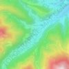
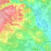
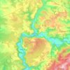
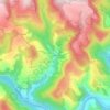
Cauterets

France > Occitania > Hautes Pyrenees

The minimum altitude, 503 metres (1,650 ft), is located in the north, where the Gave de Cauterets leaves the communal area and enters that of Soulom. The maximum elevation of 3,298 metres (10,820 ft) corresponds to the highest point of the French Pyrénées, Vignemale, marking the border with Spain [fr]. Other…

Average elevation: 1,817 m
Gascony

France > Occitania > Gers > Bazian

Average elevation: 411 m

Ax-les-Thermes

France > Occitania > Ariège > Ax-les-Thermes

Ax (from Latin Aquae – water; French Thermes – hot springs), situated at an elevation of 700 metres (2,300 ft), is well known for its sulphurous hot springs (25 to 78 °C or 77 to 172 °F). The waters, which were used by the Romans, were historically claimed to treat rheumatism, skin diseases, and other…

Average elevation: 1,449 m
Le Vigan

France > Occitania > Gard

Average elevation: 395 m

Mont Lozère

France > Occitania > Lozère

Average elevation: 1,053 m

Cazenave

France > Occitania > Ariège

Average elevation: 1,089 m

Axat

France > Occitania > Aude

Average elevation: 721 m

Arrens-Marsous

France > Occitania > Hautes Pyrenees

Average elevation: 1,714 m

Arreau

France > Occitania > Hautes Pyrenees

Average elevation: 1,022 m

Eus

France > Occitania > Pyrénées-Orientales

Average elevation: 576 m

Prats-de-Mollo-la-Preste

France > Occitania > Pyrénées-Orientales

Prats-de-Mollo-la-Preste is located in the Pyrenees, 13 km (8.1 mi) from the Spanish border and the Autonomous Community of Catalonia, on the banks of the river Tech, and on the south face of the Canigou at an elevation of 735 meters.

Average elevation: 1,295 m

Moussac

France > Occitania > Gard

Average elevation: 84 m

Cournonterral

France > Occitania > Hérault

Average elevation: 99 m

Couiza

France > Occitania > Aude

Average elevation: 353 m

Loudenvielle

France > Occitania > Hautes Pyrenees > Loudenvielle

Average elevation: 1,974 m

Montséret

France > Occitania > Aude

Average elevation: 97 m

30127

France > Occitania > Gard > Bellegarde

Average elevation: 31 m

Condom

France > Occitania > Gers

Average elevation: 127 m

Saint-Gervais-sur-Mare

France > Occitania > Hérault

Average elevation: 530 m

Fontanès-de-Sault

France > Occitania > Aude

Average elevation: 1,087 m

32130

France > Occitania > Gers > Noilhan

Average elevation: 172 m

Montaigu-de-Quercy

France > Occitania > Tarn-et-Garonne

Average elevation: 206 m

Mazamet

France > Occitania > Tarn

Average elevation: 611 m

Cordes-sur-Ciel

France > Occitania > Tarn > Cordes-sur-Ciel

Average elevation: 228 m

Lesponne

France > Occitania > Hautes Pyrenees > Bagnères-de-Bigorre

Average elevation: 1,004 m

Puy-l'Évêque

France > Occitania > Lot

Average elevation: 158 m

Quarante

France > Occitania > Hérault

Average elevation: 116 m

Saint-Denis-en-Margeride

France > Occitania > Lozère

Average elevation: 1,236 m

Espéraza

France > Occitania > Aude

Average elevation: 319 m

Campagne-sur-Aude

France > Occitania > Aude

Average elevation: 360 m

Bourg-Saint-Bernard

France > Occitania > Haute-Garonne

Average elevation: 197 m

Saint-Béat

France > Occitania > Haute-Garonne > Saint-Béat-Lez

Average elevation: 872 m

Bompas

France > Occitania > Ariège

Average elevation: 582 m

Mont

France > Occitania > Hautes Pyrenees

Average elevation: 1,336 m

Saint-Arnac

France > Occitania > Pyrénées-Orientales

Average elevation: 324 m

Cazaubon

France > Occitania > Gers

Average elevation: 128 m

Comps

France > Occitania > Gard

Average elevation: 26 m

Lozère

France > Occitania

Average elevation: 958 m

Rocamadour

France > Occitania > Lot

Average elevation: 247 m

Rignac

France > Occitania > Lot

Average elevation: 328 m

Cazouls-lès-Béziers

France > Occitania > Hérault

Average elevation: 81 m

Nissan-lez-Enserune

France > Occitania > Hérault

Viticulture strongly marked the territory. From Roman times (where it is believed the name of the village originates), the vines spread both on the plain and the hillsides. However, the massive development of this monoculture dates from the end of the 19th century, previous maps and topography attest to the…

Average elevation: 32 m

Bellegarde

France > Occitania > Gard

Average elevation: 21 m

Lauraguel

France > Occitania > Aude

Average elevation: 202 m

Salvezines

France > Occitania > Aude

Average elevation: 943 m

Portiragnes Plage

France > Occitania > Hérault > Portiragnes

Average elevation: 2 m

Hautacam

France > Occitania > Hautes Pyrenees > Beaucens

Average elevation: 1,486 m

Pris

France > Occitania > Gers > Eauze

Average elevation: 153 m

Rabieux

France > Occitania > Hérault > Ceyras

Average elevation: 123 m

Dieusses

France > Occitania > Gard > Chambon

Average elevation: 399 m

Labège

France > Occitania > Haute-Garonne

Average elevation: 165 m

Vieussan

France > Occitania > Hérault

Average elevation: 335 m

Saint-André-de-Lancize

France > Occitania > Lozère

Average elevation: 815 m

Barre-des-Cévennes

France > Occitania > Lozère

Average elevation: 891 m

Vernet-les-Bains

France > Occitania > Pyrénées-Orientales

Average elevation: 1,037 m

Sarrancolin

France > Occitania > Hautes Pyrenees

Average elevation: 1,145 m

Monts-de-Randon

France > Occitania > Lozère

Average elevation: 1,206 m

Grand-Noble

France > Occitania > Haute-Garonne > Blagnac

Average elevation: 141 m

Jacou

France > Occitania > Hérault

Average elevation: 64 m

Figeac

France > Occitania > Lot

Average elevation: 276 m

Montbrun

France > Occitania > Lozère > Gorges du Tarn Causses

Average elevation: 912 m

Aspet

France > Occitania > Haute-Garonne

Located in the middle of the Pyrenees mountain chain, within the ancient region of Comminges, Aspet sits 15 km south to Saint-Gaudens and at the foot of the Cagire (1,912 metres (6,273 ft) in Altitude).

Average elevation: 583 m

Viala-du-Tarn

France > Occitania > Aveyron

Average elevation: 640 m

Boulogne-sur-Gesse

France > Occitania > Haute-Garonne

Average elevation: 307 m

Ore

France > Occitania > Haute-Garonne

Average elevation: 530 m

Saint-Jean d'Aureilhan

France > Occitania > Hérault > Béziers

Average elevation: 39 m

Russan

France > Occitania > Gard > Sainte-Anastasie

Average elevation: 90 m

Rufat

France > Occitania > Ariège > Ax-les-Thermes

Average elevation: 994 m

Sauveplane

France > Occitania > Lozère

Average elevation: 463 m

Anduze

France > Occitania > Gard

Average elevation: 212 m

Rieupeyroux

France > Occitania > Aveyron

Average elevation: 613 m

Masseube

France > Occitania > Gers

Average elevation: 249 m

Valence-sur-Baïse

France > Occitania > Gers

Average elevation: 133 m

Castanet

France > Occitania > Tarn

Average elevation: 242 m

Belbèze-en-Comminges

France > Occitania > Haute-Garonne

Average elevation: 400 m

Eup

France > Occitania > Haute-Garonne

Average elevation: 738 m

Florac

France > Occitania > Lozère

Average elevation: 851 m

Les Angles

France > Occitania > Hautes Pyrenees

Average elevation: 529 m

Portes

France > Occitania > Gard

Average elevation: 464 m

48120

France > Occitania > Lozère > Saint-Alban-sur-Limagnole > Les Faux

Average elevation: 1,146 m

Evol

France > Occitania > Pyrénées-Orientales

Average elevation: 1,055 m

Le Minier

France > Occitania > Aveyron > Viala-du-Tarn

Average elevation: 535 m

Darré Peyrahitte

France > Occitania > Hautes Pyrenees > Lies

Average elevation: 693 m

Hameau de Besson

France > Occitania > Gard > Bragassargues

Average elevation: 133 m

Égat

France > Occitania > Pyrénées-Orientales

Average elevation: 1,689 m

Saint-Parthem

France > Occitania > Aveyron

Average elevation: 407 m

Saint-Marcel-sur-Aude

France > Occitania > Aude

Average elevation: 24 m

Gramat

France > Occitania > Lot

Average elevation: 330 m

Martel

France > Occitania > Lot

Average elevation: 219 m

Boissezon

France > Occitania > Tarn

Average elevation: 404 m

Pampelonne

France > Occitania > Tarn

Average elevation: 398 m

Arbon

France > Occitania > Haute-Garonne

Average elevation: 581 m

Altier

France > Occitania > Lozère

Average elevation: 1,046 m

About this place

 •  •  •  •  •  •  •  •  •  •  •  •  •  •

Gear up for your next adventure:

💧Hydration Bladder - Hands-free hydration solution for long treks
🥾Hiking Gaiters - Protect legs and shoes from mud, snow, and debris
🥾Trail Hiking Socks - Comfortable socks to prevent blisters and fatigue
🦌Outdoor Trail Camera - Monitor wildlife activity near your favorite spots
💡LED Camping Lantern - Illuminate your campsite with long-lasting lanterns

As an Amazon Associate, this site earns from qualifying purchases at no extra cost to you.