Geolocate

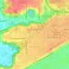
Monica topographic map

Click on the map to display elevation.

About this map

Name: Monica topographic map, elevation, terrain.

Location: Monica, Peoria County, Illinois, United States (40.90365 -89.84316 40.94365 -89.80316)

Average elevation: 230 m

Minimum elevation: 209 m

Maximum elevation: 240 m

Other topographic maps

Click on a map to view its topography, its elevation and its terrain.
Peoria

United States > Illinois > Peoria County

Average elevation: 189 m

Mapleton

United States > Illinois > Peoria County

Average elevation: 164 m

Brimfield

United States > Illinois > Peoria County

Average elevation: 213 m

Princeville

United States > Illinois > Peoria County

Average elevation: 220 m

Dunlap

United States > Illinois > Peoria County

Average elevation: 212 m

Chillicothe

United States > Illinois > Peoria County

Average elevation: 146 m

Chillicothe

United States > Illinois > Peoria County

Average elevation: 146 m

Peoria

United States > Illinois > Peoria County

Average elevation: 189 m

West Peoria

United States > Illinois > Peoria County

Average elevation: 173 m

Princeville

United States > Illinois > Peoria County

Average elevation: 220 m

Gear up for your next adventure:

📷Outdoor Action Camera - Capture high-elevation views and rugged adventures
🔭Compact Binoculars - Lightweight optics for scouting trails and wildlife
🥾Trail Hiking Socks - Comfortable socks to prevent blisters and fatigue
🧴Insect Repellent - Protect yourself from bugs during outdoor adventures
🦯Trekking Poles - Reduced impact on joints for steep topographic climbs

As an Amazon Associate, this site earns from qualifying purchases at no extra cost to you.