Geolocate

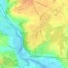
Horkesley Heath topographic map

Click on the map to display elevation.

About this map

Name: Horkesley Heath topographic map, elevation, terrain.

Location: Horkesley Heath, Colchester, Essex, England, CO6 4AZ, United Kingdom (51.90906 0.85501 51.94906 0.89501)

Average elevation: 50 m

Minimum elevation: 25 m

Maximum elevation: 62 m

Other topographic maps

Click on a map to view its topography, its elevation and its terrain.

Marks Tey

United Kingdom > England > Essex > Colchester

Average elevation: 40 m

Mount Bures

United Kingdom > England > Essex > Colchester

Average elevation: 54 m

Peldon

United Kingdom > England > Essex > Colchester > Peldon

Average elevation: 15 m

Salcott

United Kingdom > England > Essex > Colchester > Salcott

Average elevation: 8 m

Chappel

United Kingdom > England > Essex > Colchester

Average elevation: 44 m

Tiptree

United Kingdom > England > Essex > Colchester

Average elevation: 53 m

Wivenhoe

United Kingdom > England > Essex > Colchester > Rowhedge

Average elevation: 22 m

West Mersea

United Kingdom > England > Essex > Colchester

Average elevation: 6 m

Fingringhoe

United Kingdom > England > Essex > Colchester

Average elevation: 10 m

Layer Breton

United Kingdom > England > Essex > Colchester > Layer Breton

Average elevation: 30 m

Langham

United Kingdom > England > Essex > Colchester > Langham

Average elevation: 35 m

Birch

United Kingdom > England > Essex > Colchester > Birch

Average elevation: 36 m

Wivenhoe Woods

United Kingdom > England > Essex > Colchester > Wivenhoe > Rowhedge

Average elevation: 18 m

Wakes Colne

United Kingdom > England > Essex > Colchester > Wakes Colne

Average elevation: 54 m

Great Tey

United Kingdom > England > Essex > Colchester > Great Tey

Average elevation: 51 m

Aldham

United Kingdom > England > Essex > Colchester > Aldham

Average elevation: 39 m

Stanway

United Kingdom > England > Essex > Colchester

Average elevation: 36 m

Langenhoe

United Kingdom > England > Essex > Colchester > Langenhoe

Average elevation: 11 m

Wivenhoe

United Kingdom > England > Essex > Colchester > Rowhedge

Average elevation: 21 m

Gear up for your next adventure:

🧢Hiking Hat - Sun-protective and breathable hats for long treks
🔥Camping Stove - Portable stoves to cook outdoors with ease
🍽️Titanium Camping Spork - Ultralight and indestructible eating utensil
👟Trail Running Shoes - Agile footwear for fast-paced topographic exploration
🏕️Camping Hammock - Integrated protection for sleeping between trees

As an Amazon Associate, this site earns from qualifying purchases at no extra cost to you.