Geolocate

Birch topographic map

Click on the map to display elevation.

About this map

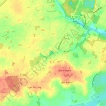
Name: Birch topographic map, elevation, terrain.

Location: Birch, Colchester, Essex, England, United Kingdom (51.82474 0.76405 51.86364 0.85221)

Average elevation: 36 m

Minimum elevation: 11 m

Maximum elevation: 57 m

Gear up for your next adventure:

🗺️Topographic Maps - Detailed maps to explore trails, mountains, and wilderness areas
🔭Compact Monocular - One-handed bird watching and trail spotting
💧Collapsible Water Bottle - Space-saving water bottle for outdoor activities
🚲Handlebar Phone Mount - View topographic-map.com live while cycling
🛶Kayak Dry Bag - Waterproof storage for kayaking adventures

As an Amazon Associate, this site earns from qualifying purchases at no extra cost to you.