Geolocate

Layer Breton topographic map

Click on the map to display elevation.

About this map

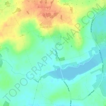
Name: Layer Breton topographic map, elevation, terrain.

Location: Layer Breton, Colchester, Essex, England, United Kingdom (51.80512 0.80294 51.83733 0.84178)

Average elevation: 30 m

Minimum elevation: 14 m

Maximum elevation: 56 m

Gear up for your next adventure:

🧳Compression Sacks - Maximize space in your backpack by shrinking gear
🪑Ultralight Camping Stool - Compact seating for rest stops during long hikes
🪜Heavy Duty Carabiners - Multi-use clips for securing gear to your backpack
🧴Waterproofing Spray - Restore the DWR coating on jackets and tents
🦯Trekking Poles - Reduced impact on joints for steep topographic climbs

As an Amazon Associate, this site earns from qualifying purchases at no extra cost to you.