Geolocate

West Mersea topographic map

Click on the map to display elevation.

About this map

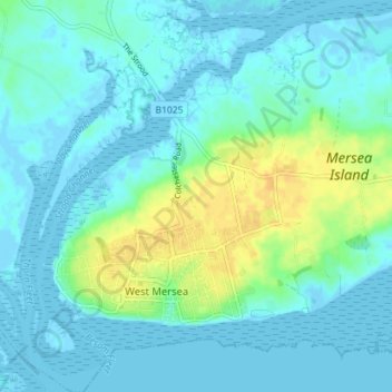
Name: West Mersea topographic map, elevation, terrain.

Location: West Mersea, Colchester, Essex, England, United Kingdom (51.76571 0.89370 51.80951 0.95639)

Average elevation: 6 m

Minimum elevation: -3 m

Maximum elevation: 23 m

Gear up for your next adventure:

💧Collapsible Water Bottle - Space-saving water bottle for outdoor activities
💡Compact LED Flashlight - Powerful and portable flashlight for outdoor use
🧊Portable Cooler - Keep food and drinks cold during outdoor adventures
🎒Fully Waterproof Backpack - Total protection for photography gear and electronics
Camping Groundsheet - Protect your tent from moisture and dirt

As an Amazon Associate, this site earns from qualifying purchases at no extra cost to you.