Geolocate

Togo topographic map

Click on the map to display elevation.

About this map

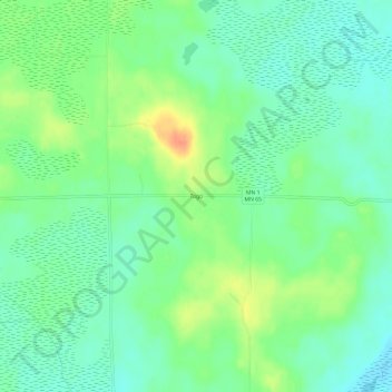
Name: Togo topographic map, elevation, terrain.

Location: Togo, Itasca County, Minnesota, United States (47.80132 -93.17601 47.84132 -93.13601)

Average elevation: 408 m

Minimum elevation: 393 m

Maximum elevation: 436 m

Other topographic maps

Click on a map to view its topography, its elevation and its terrain.

Cohasset

United States > Minnesota > Itasca County

Average elevation: 395 m

Upper Twin Lakes

United States > Minnesota > Itasca County > Rosy

Average elevation: 409 m

Keewatin

United States > Minnesota > Itasca County

Average elevation: 450 m

Warba

United States > Minnesota > Itasca County

Average elevation: 392 m

Grand Rapids

United States > Minnesota > Itasca County

Average elevation: 398 m

Grand Rapids

United States > Minnesota > Itasca County

Average elevation: 398 m

Deer River

United States > Minnesota > Itasca County

Average elevation: 393 m

Calumet

United States > Minnesota > Itasca County

Average elevation: 421 m

Cohasset

United States > Minnesota > Itasca County

Average elevation: 395 m

La Prairie

United States > Minnesota > Itasca County

Average elevation: 393 m

La Prairie

United States > Minnesota > Itasca County

Average elevation: 393 m

Bovey

United States > Minnesota > Itasca County

Average elevation: 417 m

Candy Lake

United States > Minnesota > Itasca County

Average elevation: 421 m

Taconite

United States > Minnesota > Itasca County

Average elevation: 420 m

Gear up for your next adventure:

🏃Hydration Running Vest - Carry water and maps close to your body for speed
🥾Hiking Boots - Sturdy boots providing ankle support and traction on rugged trails
🥾Trekking Boots - Durable boots for long-distance trekking
🧥Packable Rain Jacket - Breathable waterproof layer for unpredictable weather
🥾Approach Shoes - Shoes designed for climbing approaches and rugged trails

As an Amazon Associate, this site earns from qualifying purchases at no extra cost to you.