Geolocate

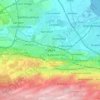
Lauriston topographic map

Click on the map to display elevation.

About this map

Name: Lauriston topographic map, elevation, terrain.

Location: Lauriston, Falkirk, Scotland, United Kingdom (55.98960 -3.75806 55.99992 -3.73425)

Average elevation: 40 m

Minimum elevation: 4 m

Maximum elevation: 115 m

Other topographic maps

Click on a map to view its topography, its elevation and its terrain.
Denny

United Kingdom > Scotland > Falkirk

Average elevation: 86 m

Falkirk

United Kingdom > Scotland > Falkirk

Falkirk is located in an area of undulating topography between the Slamannan Plateau and the upper reaches of the Firth of Forth. The area to the north of Falkirk is part of the floodplain of the River Carron. Two tributaries of the River Carron - the East Burn and the West Burn flow through the town and form…

Average elevation: 69 m
Bo'ness

United Kingdom > Scotland > Falkirk

Average elevation: 29 m

Airth

United Kingdom > Scotland > Falkirk

Average elevation: 8 m

Braes Villages

United Kingdom > Scotland > Falkirk

Average elevation: 132 m

Banknock

United Kingdom > Scotland > Falkirk

Average elevation: 93 m

Shieldhill

United Kingdom > Scotland > Falkirk

Average elevation: 151 m

Standburn

United Kingdom > Scotland > Falkirk

Average elevation: 150 m

Rumford

United Kingdom > Scotland > Falkirk > Rumford

Average elevation: 104 m

South Alloa

United Kingdom > Scotland > Falkirk > South Alloa

Average elevation: 8 m

Wallacestone

United Kingdom > Scotland > Falkirk

Average elevation: 119 m

Brightons

United Kingdom > Scotland > Falkirk

Average elevation: 89 m

Maddiston

United Kingdom > Scotland > Falkirk

Average elevation: 106 m

Torwood

United Kingdom > Scotland > Falkirk

Average elevation: 50 m

California

United Kingdom > Scotland > Falkirk

Average elevation: 159 m

Bonnybridge

United Kingdom > Scotland > Falkirk

Average elevation: 84 m

Reddingmuirhead

United Kingdom > Scotland > Falkirk

Average elevation: 102 m

Muirhouses

United Kingdom > Scotland > Falkirk

Average elevation: 46 m

Blackness

United Kingdom > Scotland > Falkirk

Average elevation: 26 m

Redding

United Kingdom > Scotland > Falkirk

Average elevation: 65 m

High Bonnybridge

United Kingdom > Scotland > Falkirk

Average elevation: 70 m

Letham

United Kingdom > Scotland > Falkirk

Average elevation: 10 m

Dennyloanhead

United Kingdom > Scotland > Falkirk

Average elevation: 70 m

Whitecross

United Kingdom > Scotland > Falkirk

Average elevation: 75 m

Longcroft

United Kingdom > Scotland > Falkirk

Average elevation: 83 m

Skinflats

United Kingdom > Scotland > Falkirk

Average elevation: 6 m

Carronshore

United Kingdom > Scotland > Falkirk

Average elevation: 13 m

Stenhousemuir

United Kingdom > Scotland > Falkirk

Average elevation: 34 m

The Helix

United Kingdom > Scotland > Falkirk > Falkirk > Glensburgh

Average elevation: 8 m

Bo'ness

United Kingdom > Scotland > Falkirk

Average elevation: 47 m

Black Loch

United Kingdom > Scotland > Falkirk > Blackloch

Average elevation: 216 m

Coneypark

United Kingdom > Scotland > Falkirk

Average elevation: 102 m

Skinflats

United Kingdom > Scotland > Falkirk

Average elevation: 6 m

Gear up for your next adventure:

🧴First Aid Kit - Essential first aid supplies for outdoor emergencies
💡Solar Camping Lamp - Eco-friendly lighting for campsites
🥾Trekking Poles - Adjustable trekking poles to reduce knee stress and improve stability
🧰Multitool Knife - Compact and versatile tool for outdoor use
🧥Waterproof Hiking Jacket - Protect yourself from rain and wind while hiking

As an Amazon Associate, this site earns from qualifying purchases at no extra cost to you.