Geolocate

Bonnybridge topographic map

Click on the map to display elevation.

About this map

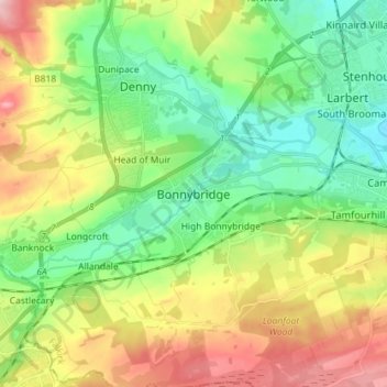
Name: Bonnybridge topographic map, elevation, terrain.

Location: Bonnybridge, Falkirk, Scotland, FK4 1BX, United Kingdom (55.96144 -3.92766 56.04144 -3.84766)

Average elevation: 84 m

Minimum elevation: 5 m

Maximum elevation: 220 m

Gear up for your next adventure:

🧥Softshell Jacket - Windproof and breathable jacket for hiking
🪑Insulated Seat Pad - Protect your seat from cold rocks and wet logs
🏃Hydration Running Vest - Carry water and maps close to your body for speed
🥾Mountain Hiking Shoes - Shoes with superior grip for mountainous terrain
🪜Heavy Duty Carabiners - Multi-use clips for securing gear to your backpack

As an Amazon Associate, this site earns from qualifying purchases at no extra cost to you.