
Make a donation
Gear up for your next adventure:
As an Amazon Associate, this site earns from qualifying purchases at no extra cost to you.
Mighraq Aakkar topographic map
Click on the map to display elevation.
Make a donation
Gear up for your next adventure:
As an Amazon Associate, this site earns from qualifying purchases at no extra cost to you.
About this map
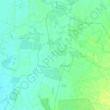
Name: Mighraq Aakkar topographic map, elevation, terrain.
Location: Mighraq Aakkar, Akkar District, Akkar Governorate, Lebanon (34.60829 36.01031 34.61660 36.02121)
Average elevation: 8 m
Minimum elevation: 1 m
Maximum elevation: 18 m
Make a donation
Gear up for your next adventure:
As an Amazon Associate, this site earns from qualifying purchases at no extra cost to you.
Other topographic maps
Click on a map to view its topography, its elevation and its terrain.
Make a donation
Gear up for your next adventure:
As an Amazon Associate, this site earns from qualifying purchases at no extra cost to you.
Shadra
The population is Greek Orthodox and other Christian. The village is situated at a distance of 146km from Beirut at an altitude of 450 m above sea level. It has an area of 651 hectares, surrounded by Akroum from the east, the west Owainat, from the north Machta Hassan and Andaket from the south . Can be…
Average elevation: 516 m
Make a donation
Gear up for your next adventure:
As an Amazon Associate, this site earns from qualifying purchases at no extra cost to you.
Make a donation
Gear up for your next adventure:
As an Amazon Associate, this site earns from qualifying purchases at no extra cost to you.
Make a donation
Gear up for your next adventure:
As an Amazon Associate, this site earns from qualifying purchases at no extra cost to you.
Make a donation
Gear up for your next adventure:
As an Amazon Associate, this site earns from qualifying purchases at no extra cost to you.