Geolocate

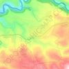
Fnaydeq topographic map

Click on the map to display elevation.

About this map

Name: Fnaydeq topographic map, elevation, terrain.

Location: Fnaydeq, Akkar District, Akkar Governorate, Lebanon (34.45571 36.16305 34.49571 36.20305)

Average elevation: 1,190 m

Minimum elevation: 711 m

Maximum elevation: 1,500 m

Other topographic maps

Click on a map to view its topography, its elevation and its terrain.

Akkar District

Lebanon > Akkar Governorate

Average elevation: 636 m

Srar

Lebanon > Akkar Governorate

Average elevation: 139 m

Sheikhlar

Lebanon > Akkar Governorate

Average elevation: 385 m

Ilat

Lebanon > Akkar Governorate

Average elevation: 397 m

Halba

Lebanon > Akkar Governorate

Average elevation: 102 m

Akkar District

Lebanon > Akkar Governorate

Average elevation: 636 m

Bebnine

Lebanon > Akkar Governorate

Average elevation: 68 m

Mounjez

Lebanon > Akkar Governorate

Average elevation: 353 m

Qarha Aakkar

Lebanon > Akkar Governorate

Average elevation: 519 m

Gear up for your next adventure:

🥾Hiking Gaiters - Protect legs and shoes from mud, snow, and debris
🥾Lightweight Hiking Shoes - Comfortable shoes for day hikes
🥾Mountaineering Boots - Supportive boots for climbing and high-altitude hiking
⛺Family Camping Tent - Spacious tent suitable for family camping trips
🥾Mountain Hiking Shoes - Shoes with superior grip for mountainous terrain

As an Amazon Associate, this site earns from qualifying purchases at no extra cost to you.