Geolocate

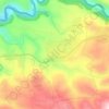
Houeich topographic map

Click on the map to display elevation.

About this map

Name: Houeich topographic map, elevation, terrain.

Location: Houeich, Akkar District, Akkar Governorate, Lebanon (34.47745 36.09888 34.51745 36.13888)

Average elevation: 518 m

Minimum elevation: 266 m

Maximum elevation: 795 m

Other topographic maps

Click on a map to view its topography, its elevation and its terrain.

Akkar District

Lebanon > Akkar Governorate

Average elevation: 636 m

Srar

Lebanon > Akkar Governorate

Average elevation: 139 m

Sheikhlar

Lebanon > Akkar Governorate

Average elevation: 385 m

Ilat

Lebanon > Akkar Governorate

Average elevation: 397 m

Halba

Lebanon > Akkar Governorate

Average elevation: 102 m

Akkar District

Lebanon > Akkar Governorate

Average elevation: 636 m

Bebnine

Lebanon > Akkar Governorate

Average elevation: 68 m

Mounjez

Lebanon > Akkar Governorate

Average elevation: 353 m

Qarha Aakkar

Lebanon > Akkar Governorate

Average elevation: 519 m

Gear up for your next adventure:

🧼Travel Hand Sanitizer - Keep hands clean when water is scarce
🧣Merino Neck Gaiter - Protects against wind, sun, and cold at high altitudes
🩹Compact First Aid Kit - Pre-packed essentials for common trail injuries
🧢Hiking Hat - Sun-protective and breathable hats for long treks
⛺Camping Tent - Weather-resistant tents suitable for 2 to 6 people

As an Amazon Associate, this site earns from qualifying purchases at no extra cost to you.