Geolocate

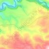
Furaydis topographic map

Click on the map to display elevation.

About this map

Name: Furaydis topographic map, elevation, terrain.

Location: Furaydis, Fraydes, Akkar District, Akkar Governorate, Lebanon (34.59419 36.20846 34.63419 36.24846)

Average elevation: 335 m

Minimum elevation: 109 m

Maximum elevation: 499 m

Other topographic maps

Click on a map to view its topography, its elevation and its terrain.

Akkar District

Lebanon > Akkar Governorate

Average elevation: 636 m

Srar

Lebanon > Akkar Governorate

Average elevation: 139 m

Sheikhlar

Lebanon > Akkar Governorate

Average elevation: 385 m

Ilat

Lebanon > Akkar Governorate

Average elevation: 397 m

Halba

Lebanon > Akkar Governorate

Average elevation: 102 m

Akkar District

Lebanon > Akkar Governorate

Average elevation: 636 m

Bebnine

Lebanon > Akkar Governorate

Average elevation: 68 m

Mounjez

Lebanon > Akkar Governorate

Average elevation: 353 m

Qarha Aakkar

Lebanon > Akkar Governorate

Average elevation: 519 m

Gear up for your next adventure:

🥫Freeze-Dried Meals - Lightweight, high-calorie nutrition for multi-day treks
👟Leg Gaiters - Keep debris, mud, and snow out of your boots
🚑Survival Whistle - Signal for help across long distances in mountains
🥾Approach Boots - Comfortable boots for hiking and climbing approaches
💡LED Headlamp - Hands-free illumination for night hiking and camping

As an Amazon Associate, this site earns from qualifying purchases at no extra cost to you.