Geolocate

Acid Lake topographic map

Click on the map to display elevation.

About this map

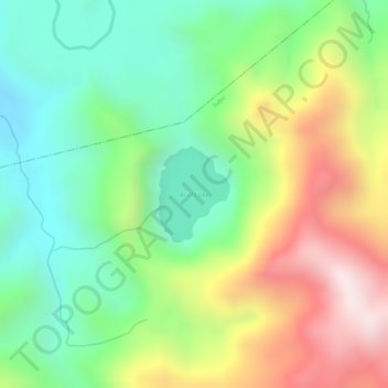
Name: Acid Lake topographic map, elevation, terrain.

Location: Acid Lake, Subic, Zambales, Central Luzon, Philippines (14.95549 120.33372 14.96220 120.33885)

Average elevation: 390 m

Minimum elevation: 147 m

Maximum elevation: 728 m

Other topographic maps

Click on a map to view its topography, its elevation and its terrain.

Pamatawan

Philippines > Zambales > Subic

Average elevation: 74 m

Batiawan

Philippines > Zambales > Subic

Average elevation: 236 m

Cawag

Philippines > Zambales > Subic

Average elevation: 58 m

Ilwas

Philippines > Zambales > Subic

Average elevation: 32 m

Aplaya Del Subic

Philippines > Zambales > Subic

Average elevation: 48 m

Aningway Sacatihan

Philippines > Zambales > Subic

Average elevation: 65 m

Aningway Sacatihan

Philippines > Zambales > Subic

Average elevation: 65 m

Aningway Sacatihan

Philippines > Zambales > Subic

Average elevation: 65 m

Pamatawan

Philippines > Zambales > Subic

Average elevation: 74 m

Cawag

Philippines > Zambales > Subic

Average elevation: 58 m

Kinabuksan

Philippines > Zambales > Subic

Average elevation: 83 m

Gear up for your next adventure:

🥾Trail Hiking Socks - Comfortable socks to prevent blisters and fatigue
👟Sport Hiking Sandals - Breathable footwear for water crossings and camp rest
🧭Orienteering Kit - Tools for map reading and navigation in the wild
🧭GPS Handheld Device - Reliable GPS navigation for outdoor adventures
🧴Waterproofing Spray - Restore the DWR coating on jackets and tents

As an Amazon Associate, this site earns from qualifying purchases at no extra cost to you.