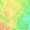
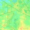
Mundelein topographic map
Click on the map to display elevation.
About this map

Name: Mundelein topographic map, elevation, terrain.
Location: Mundelein, Lake County, Illinois, 60060, United States (42.22308 -88.04397 42.30308 -87.96397)
Average elevation: 231 m
Minimum elevation: 199 m
Maximum elevation: 263 m
Other topographic maps
Click on a map to view its topography, its elevation and its terrain.
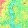
Highland Park
United States > Illinois > Lake County
In 1867, ten men purchased Highland Park for $39,198.70. They were the original stockholders of the Highland Park Building Company. Following construction of the Chicago and Milwaukee Railroad, a depot was established at Highland Park and a plat, extending south to Central Avenue, was laid out in 1856. At that…
Average elevation: 194 m


Lake Zurich
United States > Illinois > Lake County
Lake Zurich is located at 42°11′32″N 88°5′17″W / 42.19222°N 88.08806°W / 42.19222; -88.08806 (42.192324, -88.088098), with an elevation of 850 feet (260 m) above sea level.
Average elevation: 259 m
Mundelein
United States > Illinois > Lake County
Mundelein is located 33 miles (53 km) northwest of the Chicago Loop. The area of the village is 10.12 square miles (26.2 km2), 0.45 square miles (1.2 km2) of which is water. The elevation of the village is 742 feet (226 m). Mundelein borders Hawthorn Woods and Vernon Hills to the south and east, and is…
Average elevation: 231 m
Highwood
United States > Illinois > Lake County
Highwood is located in southeastern Lake County at 42°12′19″N 87°48′44″W / 42.205357°N 87.812345°W / 42.205357; -87.812345, on a ridge 100 feet (30 m) above the elevation of Lake Michigan.
Average elevation: 198 m

Waukegan
United States > Illinois > Lake County
Waukegan is on the shore of Lake Michigan, about 11 miles (18 km) south of the border with Wisconsin and 37 miles (60 km) north of downtown Chicago at an elevation around 650 feet (200 m) above sea level. Chicago has two major streets that venture north to Waukegan, one being Sheridan Road, which extends north…
Average elevation: 194 m
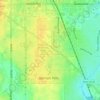
Highland Park
United States > Illinois > Lake County
In 1867, ten men purchased Highland Park for $39,198.70. They were the original stockholders of the Highland Park Building Company. Following construction of the Chicago and Milwaukee Railroad, a depot was established at Highland Park and a plat, extending south to Central Avenue, was laid out in 1856. At that…
Average elevation: 193 m
Waukegan
United States > Illinois > Lake County
Waukegan is located at 42°22′13″N 87°52′16″W / 42.37028°N 87.87111°W / 42.37028; -87.87111 (42.3703140, −87.8711404). Waukegan is on the shore of Lake Michigan, about 11 miles (18 km) south of the border with Wisconsin and 37 miles (60 km) north of downtown Chicago at an elevation around…
Average elevation: 197 m
Mundelein
United States > Illinois > Lake County
Mundelein is located 33 miles (53 km) northwest of the Chicago Loop. The area of the village is 10.12 square miles (26.2 km2), 0.45 square miles (1.2 km2) of which is water. The elevation of the village is 742 feet (226 m). Mundelein borders Hawthorn Woods and Vernon Hills to the south and east, and is…
Average elevation: 231 m
Mundelein
United States > Illinois > Lake County
Mundelein is located 33 miles (53 km) northwest of the Chicago Loop. The area of the village is 10.12 square miles (26.2 km2), 0.45 square miles (1.2 km2) of which is water. The elevation of the village is 742 feet (226 m). Mundelein borders Hawthorn Woods and Vernon Hills to the south and east, and is…
Average elevation: 231 m
Highland Park
United States > Illinois > Lake County
In 1867, ten men purchased Highland Park for $39,198.70. They were the original stockholders of the Highland Park Building Company. Following construction of the Chicago and Milwaukee Railroad, a depot was established at Highland Park and a plat, extending south to Central Avenue, was laid out in 1856. At that…
Average elevation: 193 m
Highland Park
United States > Illinois > Lake County
In 1867, ten men purchased Highland Park for $39,198.70. They were the original stockholders of the Highland Park Building Company. Following construction of the Chicago and Milwaukee Railroad, a depot was established at Highland Park and a plat, extending south to Central Avenue, was laid out in 1856. At that…
Average elevation: 194 m
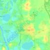
Lake Zurich
United States > Illinois > Lake County
Lake Zurich is located at 42°11′32″N 88°5′17″W / 42.19222°N 88.08806°W / 42.19222; -88.08806 (42.192324, -88.088098), with an elevation of 850 feet (260 m) above sea level.
Average elevation: 259 m
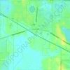
Highwood
United States > Illinois > Lake County
Highwood is located in southeastern Lake County at 42°12′19″N 87°48′44″W / 42.205357°N 87.812345°W / 42.205357; -87.812345, on a ridge 100 feet (30 m) above the elevation of Lake Michigan.
Average elevation: 198 m
Highland Park
United States > Illinois > Lake County
In 1867, ten men purchased Highland Park for $39,198.70. They were the original stockholders of the Highland Park Building Company. Following construction of the Chicago and Milwaukee Railroad, a depot was established at Highland Park and a plat, extending south to Central Avenue, was laid out in 1856. At that…
Average elevation: 194 m