Geolocate

Lake Barrington topographic map

Click on the map to display elevation.

About this map

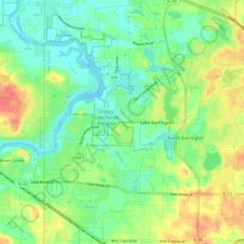
Name: Lake Barrington topographic map, elevation, terrain.

Location: Lake Barrington, Lake County, Illinois, United States (42.17511 -88.19951 42.25012 -88.13161)

Average elevation: 241 m

Minimum elevation: 219 m

Maximum elevation: 276 m

Gear up for your next adventure:

🥾Hiking Shoes - Durable and comfortable shoes for trail hiking
🥾Trail Hiking Boots - Supportive boots for rough trails
🚲Heavy Duty Bike Lock - Secure your bike at the trailhead or during stops
🥤Collapsible Travel Cup - Saves space and weight in your mess kit
🧰Emergency Multi-Tool - Compact multi-tool for outdoor survival

As an Amazon Associate, this site earns from qualifying purchases at no extra cost to you.