
Fox Lake topographic map
Click on the map to display elevation.
About this map
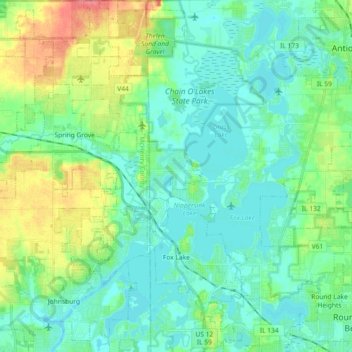
Name: Fox Lake topographic map, elevation, terrain.
Location: Fox Lake, Lake County, Illinois, 60020, United States (42.36031 -88.21877 42.49503 -88.14700)
Average elevation: 240 m
Minimum elevation: 221 m
Maximum elevation: 298 m
Other topographic maps
Click on a map to view its topography, its elevation and its terrain.
Illinois Beach State Park
United States > Illinois > Lake County
The park is located in the 12 mile long Zion Beach Ridge Plain. The Zion Beach Ridge Plain is 3,700 years old and composed of curvilinear ridge-and-swale topography. The beach ridges support black oak savanna habitat, while wetlands dominate the swales. The Zion Beach Ridge Plain has been migrating south…
Average elevation: 178 m
Lake Naomi
United States > Illinois > Lake County > Hawthorn Woods > White Birch Lakes
Average elevation: 261 m