Geolocate

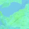
Alva topographic map

Click on the map to display elevation.

About this map

Name: Alva topographic map, elevation, terrain.

Location: Alva, Lee County, Florida, 33920, United States (26.68641 -81.70709 26.75483 -81.56626)

Average elevation: 7 m

Minimum elevation: -1 m

Maximum elevation: 14 m

Other topographic maps

Click on a map to view its topography, its elevation and its terrain.

Tice

United States > Florida > Lee County > North Fort Myers

Average elevation: 4 m

Iona

United States > Florida > Lee County

Average elevation: 2 m

Gear up for your next adventure:

🧭GPS Outdoor Watch - Smart watch for navigation and fitness tracking in nature
🧦Hiking Liner Socks - Thin base layer to prevent friction and blisters
🥾Waterproof Hiking Shoes - Durable shoes for wet and rugged trails
🧼Biodegradable Camp Soap - Environmentally friendly cleaning for gear and body
🎒Fully Waterproof Backpack - Total protection for photography gear and electronics

As an Amazon Associate, this site earns from qualifying purchases at no extra cost to you.