
Boca Grande topographic map
Click on the map to display elevation.
About this map
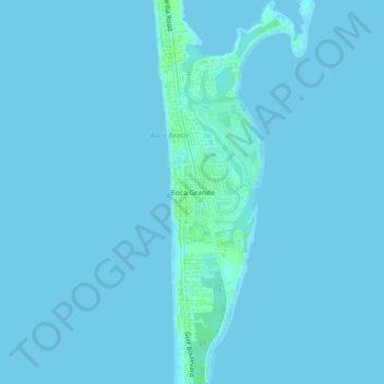
Name: Boca Grande topographic map, elevation, terrain.
Location: Boca Grande, Lee County, Florida, 33921, United States (26.72896 -82.28204 26.76896 -82.24204)
Average elevation: 1 m
Minimum elevation: -2 m
Maximum elevation: 9 m
Other topographic maps
Click on a map to view its topography, its elevation and its terrain.
Fort Myers
United States > Florida > Lee County
Fort Myers, located in Lee County, Florida, features a predominantly flat topography characterized by low elevations, averaging around 10 to 16 feet (approximately 3 to 5 meters) above sea level. The area is primarily composed of coastal plains, which contribute to its lush, subtropical vegetation and…
Average elevation: 5 m
Cape Coral
United States > Florida > Lee County
Cape Coral is characterized by its predominantly flat and low-lying terrain, with an average elevation of around 13 feet (4 meters) above sea level. The area's topography features a network of canals, with over 400 miles of navigable waterways, making it one of the most waterway-dense cities globally. The…
Average elevation: 4 m