

Kings River topographic map
Click on the map to display elevation.
About this map

Name: Kings River topographic map, elevation, terrain.
Location: Kings River, California, United States (36.05024 -119.88311 36.89934 -118.87506)
Average elevation: 221 m
Minimum elevation: 53 m
Maximum elevation: 2,350 m
Other topographic maps
Click on a map to view its topography, its elevation and its terrain.
San Francisco Bay Area
United States > California > San Francisco
The San Francisco Bay Area is characterized by a diverse and dynamic topography shaped by geological processes over millions of years. This region features a combination of coastal plains, steep hills, and rugged mountains, all influenced by the tectonic activity associated with the nearby San Andreas Fault…
Average elevation: 113 m
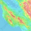
Santa Cruz Mountains
United States > California > Santa Clara County
The Santa Cruz Mountains are a region of great biological diversity, encompassing cool, moist coastal ecosystems as well as warm, dry chaparral. Much of the area in the Santa Cruz mountains is considered temperate rainforest. In valleys and moist ocean-facing slopes some of the southernmost coast redwoods…
Average elevation: 230 m


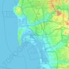
San Diego
United States > California > San Diego County > San Diego
The climate in San Diego, like most of Southern California, often varies significantly over short geographical distances, resulting in microclimates. In San Diego, this is mostly because of the city's topography (the Bay, and the numerous hills, mountains, and canyons). Frequently, particularly during the "May…
Average elevation: 57 m
El Dorado Hills
United States > California > El Dorado County > Cameron Park
El Dorado Hills (EDH), as defined by the 2010 census-designated place (CDP), is at the western border of El Dorado County, between the City of Folsom and the unincorporated community of Cameron Park. The northern limits of the CDP are Folsom Lake and the South Fork of the American River, where river rafters…
Average elevation: 254 m


General Sherman Tree
United States > California > Tulare County
General Sherman is a giant sequoia (Sequoiadendron giganteum) tree located at an elevation of 2,109 m (6,919 ft) above sea level in the Giant Forest of Sequoia National Park in Tulare County, in the U.S. state of California. By volume, it is the largest known living single-stem tree on Earth.
Average elevation: 2,114 m
San Fernando Valley
United States > California > Los Angeles County > Los Angeles
Average elevation: 496 m
San Francisco Bay Area
United States > California > San Francisco
The borders of the San Francisco Bay Area are not officially delineated, and the unique development patterns influenced by the region's topography, as well as unusual commute patterns caused by the presence of three central cities and employment centers located in various suburban locales, has led to…
Average elevation: 113 m

White Mountain Peak
United States > California > Mono County
It is the fourteenth most topographically prominent peak in the contiguous United States. White Mountain Peak is one of only two fourteeners (peaks above 14,000 feet) in California that are not in the Sierra Nevada, the other being Mount Shasta at the far northern end of the state in the Cascade Range. It is…
Average elevation: 3,880 m
Coachella Valley
United States > California > Riverside County > Palm Desert
The area is surrounded on the southwest by the Santa Rosa Mountains, by the San Jacinto Mountains to the west, the Little San Bernardino Mountains to the east and San Gorgonio Mountain to the north. These mountains peak at around 11,000 feet (3,400 m) and tend to average between 5,000 and 7,000 feet (1,500 and…
Average elevation: 72 m
Newport Beach
United States > California > Orange County > Newport Beach > Newport Beach
Newport Beach extends in elevation from sea level to the 1,161 ft (354 m) summit of Signal Peak in the San Joaquin Hills, but the official elevation is 25 ft (7.6 m) above sea level at a location of 33°37′0″N 117°53′51″W / 33.61667°N 117.89750°W / 33.61667; -117.89750 (33.616671, −117.897604).
Average elevation: 9 m
San Fernando Valley
United States > California > Los Angeles County > Los Angeles
Average elevation: 496 m



Mount Shasta
United States > California > Siskiyou County
Mount Shasta (/ˈʃæstə/ SHASS-tə; Shasta: Waka-nunee-Tuki-wuki; Karuk: Úytaahkoo) is a potentially active volcano at the southern end of the Cascade Range in Siskiyou County, California. At an elevation of 14,179 feet (4,321.8 meters), it is the second-highest peak in the Cascades and the fifth-highest in…
Average elevation: 3,717 m


Del Cerro Park
United States > California > Los Angeles County > Rancho Palos Verdes
Average elevation: 274 m
Diamond Springs
United States > California > El Dorado County
Diamond Springs (formerly, Diamond Spring and Diamond) is a census-designated place (CDP) in El Dorado County, California, United States. It is part of the Sacramento–Arden-Arcade–Roseville Metropolitan Statistical Area. The population was 11,037 at the 2010 census, up from 4,888 at the 2000 census. The…
Average elevation: 542 m
Mount Whitney
United States > California > Tulare County
Mount Whitney (Paiute: Tumanguya; Too-man-i-goo-yah) is the highest mountain in the contiguous United States and the Sierra Nevada, with an elevation of 14,505 feet (4,421 m). It is in East–Central California, on the boundary between California's Inyo and Tulare counties, 84.6 miles (136.2 km) west-northwest…
Average elevation: 3,903 m
Golden Gate Park
United States > California > San Francisco
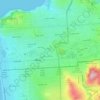
In the 1860s, San Franciscans began to feel the need for a spacious public park similar to Central Park, which was then taking shape in New York City. Golden Gate Park was carved out of unpromising sand and shore dunes that were known as the Outside Lands, in an unincorporated area west of San Francisco's…
Average elevation: 71 m
Santa Monica Mountains
United States > California > Los Angeles County
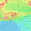
On January 17, 2007, an unusually cold storm brought snow in the Santa Monica Mountains. The hills above Malibu picked up three inches (eight centimeters) of snow - the first measurable snow in fifty years. Snow was reported on Boney Peak in the winter of 2005; and in March 2006, snow also fell on the summit…
Average elevation: 201 m
Mount San Antonio
United States > California > Los Angeles County
The prehistoric Hog Back landslide lies in the canyon of San Antonio Creek at 4000' elevation. When the slide occurred, it dammed the river, whose depth built up until the water was released catastrophically, forming a slot canyon which now holds some of the area's few good rock climbing routes (difficulty…
Average elevation: 2,675 m
Hungry Valley SVRA
United States > California > Los Angeles County > Gorman
Average elevation: 1,303 m
Berkeley Hills
United States > California > Alameda County > Berkeley
The Berkeley Hills are bounded by the major Hayward Fault along their western base, and the minor Wildcat fault on their eastern side. The highest peaks are Grizzly Peak with an elevation of 1,754 feet (535 m) and Round Top, an extinct volcano with an elevation of 1,761 feet (537 m) and William Rust Summit at…
Average elevation: 158 m

San Gorgonio Mountain
United States > California > San Bernardino County
Since it is the highest point in a region which is separated from higher peaks (e.g. in the Sierra Nevada) by relatively low terrain, San Gorgonio Mountain is one of the most topographically prominent peaks in the United States. It is ranked 7th among peaks in the 48 contiguous states and 18th overall.
Average elevation: 3,154 m
Mammoth Mountain
United States > California > Mono County > Mammoth Lakes
Mammoth Mountain is a lava dome complex in Mono County, California. It lies in the southwestern corner of the Long Valley Caldera and consists of about 12 rhyodacite and dacite overlapping domes. These domes formed in a long series of eruptions from 110,000 to 57,000 years ago, building a volcano that reaches…
Average elevation: 3,011 m
Green Valley
United States > California > Los Angeles County
Green Valley is an unincorporated community and census-designated place (CDP) in the Sierra Pelona Mountains, in Los Angeles County, California. It lies at an elevation of 2936 feet (895 m). The population was 1,036 at the 2020 census, up from 1,027 at the 2010 census.
Average elevation: 1,057 m

McKinleyville
United States > California > Humboldt County
McKinleyville (formerly Minorsville) is a census-designated place (CDP) in Humboldt County, California McKinleyville is located 5.25 miles (8.4 km) north of Arcata, at an elevation of 141 feet (43 m). The population was 15,177 at the 2010 census, up from 13,599 at the time of the 2000 census.
Average elevation: 49 m


West Puente Valley
United States > California > Los Angeles County > West Puente Valley
Average elevation: 101 m
Woodside Village
United States > California > Los Angeles County > West Covina
Average elevation: 176 m

Point Dume
United States > California > Los Angeles County > Malibu
Offshore, the nutrient-rich and frigid waters of the Pacific enhance the entire marine food web, from primary producers such as algae and zooplankton to apex predators like sand sharks, bottlenose dolphins, and gray whales. Within the Marine Protected Areas (MPAs), the diverse seafloor topography encompasses…
Average elevation: 12 m
Portuguese Bend
United States > California > Los Angeles County > Rancho Palos Verdes
Average elevation: 66 m
Oak Hill
United States > California > Los Angeles County > Unincorporated Santa Monica Mountains
Average elevation: 478 m



Oak Spring Canyon Park
United States > California > Los Angeles County > Santa Clarita
Average elevation: 519 m



Mount Sutro
United States > California > San Francisco
The low mountain is 909 feet (277 m) in elevation. Mount Sutro is one of the many named hills within San Francisco, and among its original "Seven Hills".
Average elevation: 142 m

Badwater Basin
United States > California > Inyo County
The pool is not the lowest point of the basin: the lowest point (which is only slightly lower) is several miles to the west and varies in position, depending on rainfall and evaporation patterns. The salt flats are hazardous to traverse (in many cases being only a thin white crust over mud), and so the sign…
Average elevation: -74 m
Mount Shasta
United States > California > Siskiyou County
Mount Shasta (Shasta: Waka-nunee-Tuki-wuki; Karuk: Úytaahkoo) is a potentially active volcano at the southern end of the Cascade Range in Siskiyou County, California. At an elevation of 14,179 feet (4,321.8 meters), it is the second-highest peak in the Cascades and the fifth-highest in the state. Mount Shasta…
Average elevation: 3,717 m
Hilmar
United States > California > Merced County
Hilmar is an unincorporated community in Merced County, California, United States. It is located 4.25 miles (6.8 km) west-southwest of Delhi, spanning 3.9 sq mi (10 km2) and at an elevation of 92 ft (28 m) above sea level. For census purposes, Hilmar is aggregated with a nearby community into the Hilmar-Irwin…
Average elevation: 30 m

Markleeville
United States > California > Alpine County
Markleeville hosts an annual bicycle ride called the Death Ride - Tour of the California Alps. The route goes over five passes for a total distance of 129 miles and over 15,000 feet of elevation gain. In 2010 3,500 riders participated and 2,417 completed the full course of 5 mountain passes.
Average elevation: 1,788 m